LOV MEMBER
People working@LOV

CONTACT : Edouard Leymarie

Laboratoire d'Océanographie de Villefranche, LOV
Institut de la Mer de Villefranche, IMEV
181 Chemin du Lazaret
06230 Villefranche-sur-Mer (France)

Research engineer

@ OMTAB

Edouard Leymarie

Current position :

2003-present: Research Engineer

Status :

Permanent

Employer :

CNRS

Team(s) :

Hosting Lab :

LOV (UMR 7093)

Keywords :

marine optics, radiative transfert, monte carlo, instrumentation, profiling float, ocean color, bgc argo floats

Complementary Information

Edouard Leymarie is a research engineer at LOV since 2003. He led the technological development of several optical instruments for in-situ radiometric measurements such as a radiance camera or a patented scatterometer. He also developed the SimulO software, which provides an easy-to-use interface for performing optical simulations and shading calculations using the Monte-Carlo method. After developing the ProVal Argo profiler as part of a CNES-funded project, he now supervises the team's technological developments on BGC-Argo profilers, such as the ERC REFINE profiler. He is in charge of WP3 of the PIANO project, funded by Ifremer, and dedicated to the development of new BGC sensors on floats. He is also co-leader of WP3 of the European GEORGE project on improving autonomous platforms for the characterization of the ocean carbon system. At the French level, Edouard Leymarie is a member of the Argo France steering committee. At the international level, he is part of the BGC-Argo mission team and co-leads the new Technical Task Team dedicated to sensors for the BGC-Argo mission.

Facilities

PUBLICATIONS BY

Edouard Leymarie

49 documents 🔗 HAL Profile
  • Louise Delaigue, Pierre Cauchy, Dorian Cazau, Julien Bonnel, Sara Pensieri, Roberto Bozzano, Anatole Gros-Martial, Christophe Schaeffer, Arnaud David, Paco Stil, Antoine Poteau, Catherine Schmechtig, Edouard Leymarie, Hervé Claustre. Ocean Science (2026). ART
    Abstract

    Abstract. Wind forcing plays a pivotal role in driving upper-ocean physical and biogeochemical processes, yet direct wind observations remain sparse in many regions of the global ocean. While passive acoustics have been used to estimate wind speed from moored and mobile platforms, their application to profiling floats has been demonstrated only in limited cases. Here we report the first deployment of a biogeochemical profiling float equipped with a passive acoustic sensor explicitly designed for wind retrieval, aimed at detecting wind-driven surface signals from depth. The float was deployed in the northwestern Mediterranean Sea near the DYFAMED (DYnamique des Flux Atmosphériques en MEDiterranée) meteorological buoy from February to April 2025 and operated at parking depths of 500–1000 m. We demonstrate that wind speed can be successfully retrieved from subsurface ambient noise using established acoustic algorithms, with float-derived estimates showing good agreement with collocated surface observations. To evaluate scalability to remote regions, we simulate a remote deployment scenario by refitting the acoustic model of Nystuen et al. (2015) using ERA5 reanalysis as a reference for surface wind. The ERA5-based calibration performs well under moderate winds but exhibits systematic high-wind bias (≥ 10 m s−1). Finally, we apply a residual learning framework to correct these estimates using a limited subset of DYFAMED wind data, simulating conditions where only brief surface observations are available. The corrected wind time series achieved a 38.6 % reduction in RMSE, demonstrating the effectiveness of combining reanalysis with sparse in-situ calibration. This framework improves agreement with in-situ wind observations relative to reanalysis alone, supporting a scalable strategy for float-based wind monitoring in data-sparse ocean regions. Such capability has direct implications for improving estimates of air–sea exchanges, interpreting biogeochemical fluxes, and advancing climate-relevant ocean observing.

  • Anatole Gros-Martial, Louise Delaigue, Pierre Cauchy, Sara Pensieri, Roberto Bozzano, Julien Bonnel, Edouard Leymarie, Mark Baumgartner, Christophe Guinet, Sara Bazin, Dorian Cazau. OCEANS 2025 Brest, BREST, France, 2025 (2025). ART
    Abstract

    Passive acoustic monitoring is a promising tool for long-term ocean observations, offering a unique means to capture physical and biological processes. This study explores its potential as a source of fine temporal scale in-situ wind speed product by assembling a unique corpus of acoustic datasets co-located with or near in-situ weather stations. This study offers two key contributions: i) setting up a benchmarking framework for the development and evaluation of models in acoustic meteorology, and ii) applying this framework to assess the performance of various models, comparing parameters from the literature with those trained on datasets from this study's corpus. Regarding the latter point, results show that most untrained models fail to generalize due to the intrinsic variability of soundscape in different basins and environmental conditions, as well as calibration inaccuracies. However, all models can achieve satisfactory performance on specific datasets after training. Incorporating diverse observational sources, such as gliders and BGC-Argo floats, could enhance model robustness, and improved acoustic-based estimates will help refine satellite-derived wind products and numerical weather predictions, ultimately advancing global wind field modeling and air-sea interaction research.

  • Jaime Pitarch, Edouard Leymarie, Vincenzo Vellucci, Luca Massi, Hervé Claustre, Antoine Poteau, David Antoine, Emanuele Organelli. Limnology and Oceanography: Methods (2025). ART
    Abstract

    Abstract Photosynthetic available radiation (PAR) is the light usable by photosynthetic organisms. Photosynthetic available radiation measurements at depth are required to quantify the light availability for primary production. Direct PAR measurements may be measured with full‐spectrum quantum sensors for the range 400 to 700 nm. When spectrally resolved light is measured, as for the downwelling irradiance spectrum , PAR may be computed by numerically integrating within those limits. As radiation varies across a spectral continuum, needs to be resolved at a sufficiently large number of bands, to provide an unbiased PAR estimate. When is available at a small number of spectral bands, as for multispectral sensors, it is still possible to numerically integrate , but the estimation will contain errors. Here, we propose a method that delivers unbiased PAR estimates, based on two‐layer neural networks, formulable in a small number of matrix equations, and thus exportable to any software platform. The method was calibrated with a dataset of hyperspectral acquired by new types of BioGeoChemical (BGC)‐Argo floats deployed in a variety of open ocean locations, representative of a wide range of bio‐optical properties. This procedure was repeated for several band configurations, including those existing on multispectral radiometers presently the standard for the BGC‐Argo fleet. Validation results against independent data were highly satisfactory, displaying minimal uncertainties across a wide PAR range, with the performance varying as a function of each sensor configuration, overall supporting the operational implementation in the Argo program. Model codes are findable at https://github.com/jaipipor/PAR_BGC_Argo .

  • Anatole Gros-Martial, Louise Delaigue, Pierre Cauchy, Sara Pensieri, Roberto Bozzano, Julien Bonnel, Edouard Leymarie, Mark Baumgartner, Christophe Guinet, Sara Bazin, Dorian Cazau. OCEANS 2025 Brest (2025). PROCEEDINGS
  • Jing Tan, Robert Frouin, Edouard Leymarie, B. Greg Mitchell. Optics Express (2025). ART
    Abstract

    Biogeochemical (BGC) Argo floats currently measure downwelling planar irradiance ( E d ) at three spectral wavelengths (380, 443, and 490 nm) and photosynthetically available radiation (PAR) in the 400–700 nm range. In next-generation floats, replacing the PAR sensor with a 555 nm band is under consideration to enhance spectral resolution while still enabling accurate PAR reconstruction from the existing measurements. This study proposes a General Additive Model (GAM) to estimate PAR at any given depth (z) from just below the surface (z = 0 m) to 200 m using E d at 380, 443, 490, and 555 nm. The model coefficients are functions of z, and the possibility of introducing chlorophyll concentration ([Chl] ) as an extra parameter is also evaluated. Theoretical simulations conducted under diverse environmental conditions show that PAR(z) can be estimated with high accuracy. When using depth as the sole explanatory variable, the estimate bias ranges from 0 to -0.59 µE/m 2 /s and root mean square deviations (RMSD) between 0.01 and 8.23 µE/m 2 /s. Percent bias is near-zero across all depths with slightly elevated values near the surface and around 200 m, i.e., -0.2% and 0.5%, respectively. Relative RMSD is about 1-2% at the surface depths and gradually increases to about 8% at 200 m. Including [Chl] as an extra explanatory variable did not significantly improve model performance, probably attributed to the uncertainties in [Chl] measurements. Validation against various in-situ E d profiles confirms the model’s robustness, i.e., with an overall model bias of -0.8% and an RMSD of 4.8% across 120,115 in-situ cases, accurately capturing near-surface variability and maintaining consistent performance, i.e., less than 10% relative error for PAR ranging from 10 3 to 10 −2 µE/m 2 /s. Theoretical uncertainty of the PAR estimates was also quantified as a function of depth and estimated PAR, providing an uncertainty value for each estimate and showing good agreement with actual uncertainties. The proposed model benefits the BGC Argo program by expanding the E d dataset within the photosynthetically active range and offering accurate PAR estimates across diverse environmental conditions.

  • Alberto Baudena, Rémi Laxenaire, Camille Catalano, Artemis Ioannou, Edouard Leymarie, Marc Picheral, Antoine Poteau, Sabrina Speich, Lars Stemmann, Rainer Kiko. Communications Earth & Environment (2025). ART
  • Raphaël Larouche, Simon Lambert-Girard, Christian Katlein, Sabine Marty, Edouard Leymarie, Simon Thibault, Marcel Babin. Applied optics (2024). ART
    Abstract

    Improved miniaturization capabilities for complex fisheye camera systems have recently led to the introduction of many compact 360-degree cameras on the consumer technology market. Designed primarily for recreational photography, several manufacturers have decided to allow users access to raw imagery for further editing flexibility, thereby offering data at a sensor level that can be directly exploited for absolute-light quantification. In this study, we demonstrate methodologies to carefully calibrate a consumer-grade 360-degree camera for radiometry use. The methods include linearity analysis, geometric calibration, assessment of the illumination fall-off across the image plane, spectral-response determination, absolute spectral-radiance calibration, immersion factor determination, and dark-frame analysis. Accuracy of the calibration was validated by a real-world experiment comparing sky radiance measurements with a colocalized compact optical profiling system (C-OPS, Biospherical Instruments Inc.), which gave mean unbiased percentage differences of less than 21.1%. Using the photon-transfer technique, we calculated that this camera consisting of two fisheyes with a 182° field of view in air (152° in water) has a limit of detection of at least 4.6×10 −7 W⋅sr −1 ⋅m −2 ⋅nm −1 in its three spectral channels. This technology, with properly stored calibration data, may benefit researchers from multiple scientific areas interested in radiometric geometric light-field study. While some of these radiometric calibration methods are complex or costly, this work opens up possibilities for easy-to-use, inexpensive, and accessible radiance cameras.

  • Edouard Leymarie. AST-23 Argo Science Team 23 (2022). COMM
    Abstract

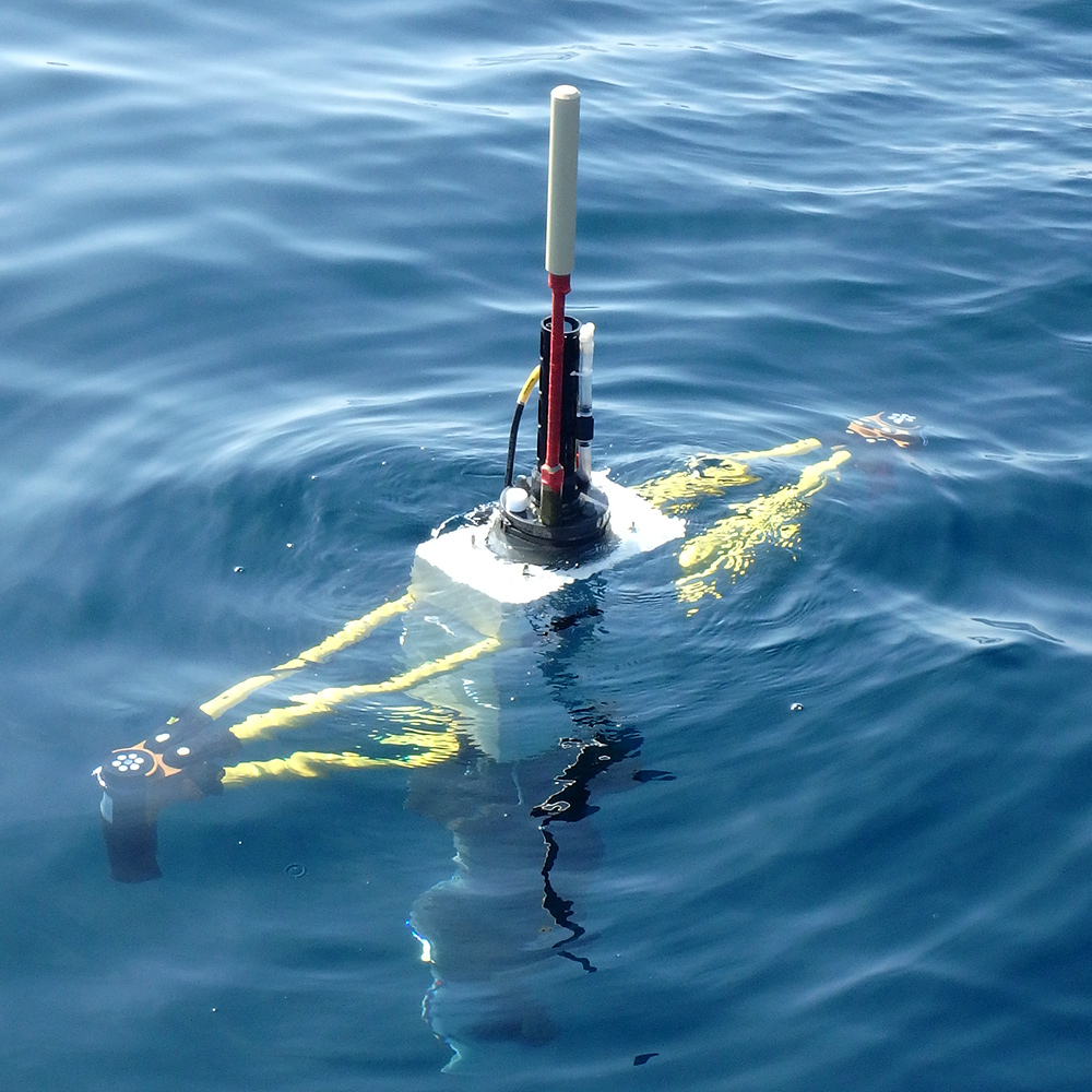
    This presentation describes the new BGC profiler "Provor CTS5" and the new sensors on board.

  • Flavienne Bruyant, Rémi Amiraux, Marie-Pier Amyot, Philippe Archambault, Lise Artigue, Lucas Bardedo de Freitas, Guislain Bécu, Simon Bélanger, Pascaline Bourgain, Annick Bricaud, Etienne Brouard, Camille Brunet, Tonya Burgers, Danielle Caleb, Katrine Chalut, Hervé Claustre, Marcel Babin, Véronique Cornet-Barthaux, Pierre Coupel, Marine Cusa, Fanny Cusset, Laeticia Dadaglio, Marty Davelaar, Gabriele Deslongchamps, Céline Dimier, Julie Dinasquet, Dany Dumont, Brent Else, Igor Eulaers, Joannie Ferland, Gabrielle Filteau, Marie-Hélène Forget, Jérôme Fort, Louis Fortier, Martí Galí-Tapías, Morgane Gallinari, Svend-Erik Garbus, Nicole Garcia, Catherine Gérikas Ribeiro, Colline Gombault, Priscilla Gourvil, Clémence Goyens, Cindy Grant, Pierre-Luc Grondin, Pascal Guillot, Sandrine Hillion, Rachel Hussher, Fabien Joux, Hannah Joy-Warren, Gabriel Joyal, David Kieber, Augustin Lafond, José Lagunas, Patrick Lajeunesse, Catherine Lalande, Jade Larivière, Florence Le Gall, Karine Leblanc, Mathieu Leblanc, Justine Legras, Keith Levesque, Kate-Marie Lewis, Edouard Leymarie, Aude Leynaert, Thomas Linkowski, Martine Lizotte, Adriana Lopes dos Santos, Claudie Marec, Dominique Marie, Guillaume Massé, Philippe Massicotte, Atsushi Matsuoka, Lisa Miller, Sharif Mirshak, Nathalie Morata, Brivaela Moriceau, Philippe-Israël Morin, Simon Morisset, Anders Mosbech, Alfonso Mucci, Gabrielle Nadaï, Christian Nozais, Ingrid Obernosterer, Timothe Paire, Christos Panagiotopoulos, Marie Parenteau, Noémie Pelletier, Marc Picheral, Bernard Quéguiner, Patrick Raimbault, Joséphine Ras, Eric Rehm, Llúcia Ribot Lacosta, Jean-François Rontani, Blanche Saint-Béat, Julie Sansoulet, Noé Sardet, Catherine Schmechtig, Antoine Sciandra, Richard Sempéré, Caroline Sévigny, Jordan Toullec, Margot Tragin, Jean-Eric Tremblay, Annie-Pier Trottier, Daniel Vaulot, Anda Vladoiu, Lei Xue, Gustavo Yunda-Guarin. Earth System Science Data (2022). ART
    Abstract

    Abstract. The Green Edge project was designed to investigate the onset, life and fate of a phytoplankton spring bloom (PSB) in the Arctic Ocean. The lengthening of the ice-free period and the warming of seawater, amongst other factors, have induced major changes in arctic ocean biology over the last decades. Because the PSB is at the base of the Arctic Ocean food chain, it is crucial to understand how changes in the arctic environment will affect it. Green Edge was a large multidisciplinary collaborative project bringing researchers and technicians from 28 different institutions in seven countries, together aiming at understanding these changes and their impacts into the future. The fieldwork for the Green Edge project took place over two years (2015 and 2016) and was carried out from both an ice-camp and a research vessel in the Baffin Bay, canadian arctic. This paper describes the sampling strategy and the data set obtained from the research cruise, which took place aboard the Canadian Coast Guard Ship (CCGS) Amundsen in spring 2016. The dataset is available at https://doi.org/10.17882/59892 (Massicotte et al., 2019a).

  • B Juhls, A Matsuoka, M Lizotte, G Bécu, P P Overduin, J El Kassar, E Devred, D Doxaran, J Ferland, M H Forget, A Hilborn, M Hieronymi, E Leymarie, J Maury, L Oziel, L Tisserand, D O J Anikina, M Dillon, M Babin. Remote Sensing of Environment (2022). ART
  • Marie Barbieux, Julia Uitz, Alexandre Mignot, Collin Roesler, Hervé Claustre, Bernard Gentili, Vincent Taillandier, Fabrizio d'Ortenzio, Hubert Loisel, Antoine Poteau, Edouard Leymarie, Christophe Penkerc'H, Catherine Schmechtig, Annick Bricaud. Biogeosciences (2022). ART
    Abstract

    This study assesses marine community production based on the diel variability of bio-optical properties monitored by two BioGeoChemical-Argo (BGC-Argo) floats. Experiments were conducted in two distinct Mediterranean systems, the northwestern Ligurian Sea and the central Ionian Sea, during summer months. We derived particulate organic carbon (POC) stock and gross community production integrated within the surface, euphotic and subsurface chlorophyll maximum (SCM) layers, using an existing approach applied to diel cycle measurements of the particulate beam attenuation (c<sub>p</sub>) and backscattering (b<sub>bp</sub>) coefficients. The diel cycle of c<sub>p</sub> provided a robust proxy for quantifying biological production in both systems; that of b<sub>bp</sub> was comparatively less robust. Derived primary production estimates vary by a factor of 2 depending upon the choice of the bio-optical relationship that converts the measured optical coefficient to POC, which is thus a critical step to constrain. Our results indicate a substantial contribution to the water column production of the SCM layer (16 %-42 %), which varies largely with the considered system. In the Ligurian Sea, the SCM is a seasonal feature that behaves as a subsurface biomass maximum (SBM) with the ability to respond to episodic abiotic forcing by increasing production. In contrast, in the Ionian Sea, the SCM is permanent, primarily induced by phytoplankton photoacclimation, and contributes moderately to water column production. These results clearly demonstrate the strong potential for transmissometers deployed on BGC-Argo profiling floats to quantify non-intrusively in situ biological production of organic carbon in the water column of stratified oligotrophic systems with recurring or permanent SCMs, which are widespread features in the global ocean.

  • Marc Picheral, Camille Catalano, Denis Brousseau, Hervé Claustre, Laurent Coppola, Edouard Leymarie, Jérôme Coindat, Fabio Dias, Sylvain Fevre, Lionel Guidi, Jean-Olivier Irisson, Louis Legendre, Fabien Lombard, Laurent Mortier, Christophe Penkerch, Andreas Rogge, Catherine Schmechtig, Simon Thibault, Thierry Tixier, Anya Waite, Lars Stemmann. Limnology and Oceanography: Methods (2022). ART
    Abstract

    Autonomous and cabled platforms are revolutionizing our understanding of ocean systems by providing 4D monitoring of the water column, thus going beyond the reach of ship-based surveys and increasing the depth of remotely sensed observations. However, very few commercially available sensors for such platforms are capable of monitoring large particulate matter (100-2000 μm) and plankton despite their important roles in the biological carbon pump and as trophic links from phytoplankton to fish. Here, we provide details of a new, commercially available scientific camera-based particle counter, specifically designed to be deployed on autonomous and cabled platforms: the Underwater Vision Profiler 6 (UVP6). Indeed, the UVP6 camera-and-lighting and processing system, while small in size and requiring low power, provides data of quality comparable to that of previous much larger UVPs deployed from ships. We detail the UVP6 camera settings, its performance when acquiring data on aquatic particles and plankton, their quality control, analysis of its recordings, and streaming from in situ acquisition to users. In addition, we explain how the UVP6 has already been integrated into platforms such as BGC-Argo floats, gliders and long-term mooring systems (autonomous platforms). Finally, we use results from actual deployments to illustrate how UVP6 data can contribute to addressing longstanding questions in marine science, and also suggest new avenues that can be explored using UVP6-equipped autonomous platforms.

  • Flavienne Bruyant, Rémi Amiraux, Marie-Pier Amyot, Philippe Archambault, Lise Artigue, Lucas Barbedo de Freitas, Guislain Bécu, Simon Bélanger, Pascaline Bourgain, Annick Bricaud, Etienne Brouard, Camille Brunet, Tonya Burgers, Danielle Caleb, Katrine Chalut, Hervé Claustre, Marcel Babin, Antoine Sciandra, Veronique Cornet, Pierre Coupel, Marine Cusa, Fanny Cusset, Laeticia Dadaglio, Marty Davelaar, Gabrièle Deslongchamps, Céline Dimier, Julie Dinasquet, Dany Dumont, Brent Else, Igor Eulaers, Joannie Ferland, Gabrielle Filteau, Marie-Hélène Forget, Jérome Fort, Louis Fortier, Martí Galí, Morgane Gallinari, Svend-Erik Garbus, Nicole Garcia, Catherine Gérikas Ribeiro, Colline Gombault, Priscillia Gourvil, Clémence Goyens, Cindy Grant, Pierre-Luc Grondin, Pascal Guillot, Sandrine Hillion, Rachel Hussherr, Fabien Joux, Hannah Joy-Warren, Gabriel Joyal, David Kieber, Augustin Lafond, José Lagunas, Patrick Lajeunesse, Catherine Lalande, Jade Larivière, Florence Le Gall, Karine Leblanc, Mathieu Leblanc, Justine Legras, Keith Lévesque, Kate-M. Lewis, Edouard Leymarie, Aude Leynaert, Thomas Linkowski, Martine Lizotte, Adriana Lopes dos Santos, Claudie Marec, Dominique Marie, Guillaume Massé, Philippe Massicotte, Atsushi Matsuoka, Lisa A. Miller, Sharif Mirshak, Nathalie Morata, Brivaela Moriceau, Philippe-Israël Morin, Simon Morisset, Anders Mosbech, Alfonso Mucci, Gabrielle Nadaï, Christian Nozais, Ingrid Obernosterer, Thimoté Paire, Christos Panagiotopoulos, Marie Parenteau, Noémie Pelletier, Marc Picheral, Bernard Queguiner, Patrick Raimbault, Josephine Ras, Eric Rehm, Llúcia Ribot Lacosta, Jean-Francois Rontani, Blanche Saint-Béat, Julie Sansoulet, Noé Sardet, Catherine Schmechtig, Richard Sempere, Caroline Sévigny, Jordan Toullec, Margot Tragin, Jean-Éric Tremblay, Annie-Pier Trottier, Daniel Vaulot, Anda Vladoiu, Lei Xue, Gustavo Yunda-Guarin. Earth System Science Data (2022). ART
    Abstract

    The Green Edge project was designed to investigate the onset, life, and fate of a phytoplankton spring bloom (PSB) in the Arctic Ocean. The lengthening of the ice-free period and the warming of seawater, amongst other factors, have induced major changes in Arctic Ocean biology over the last decades. Because the PSB is at the base of the Arctic Ocean food chain, it is crucial to understand how changes in the Arctic environment will affect it. Green Edge was a large multidisciplinary, collaborative project bringing researchers and technicians from 28 different institutions in seven countries together, aiming at understanding these changes and their impacts on the future. The fieldwork for the Green Edge project took place over two years (2015 and 2016) and was carried out from both an ice camp and a research vessel in Baffin Bay, in the Canadian Arctic. This paper describes the sampling strategy and the dataset obtained from the research cruise, which took place aboard the Canadian Coast Guard ship (CCGS) Amundsen in late spring and early summer 2016. The sampling strategy was designed around the repetitive, perpendicular crossing of the marginal ice zone (MIZ), using not only ship-based station discrete sampling but also high-resolution measurements from autonomous platforms (Gliders, BGC-Argo floats …) and under-way monitoring systems. The dataset is available at https://doi.org/10.17882/86417 (Bruyant et al., 2022).

  • Philippe Massicotte, Rainer Amon, David Antoine, Philippe Archambault, Sergio Balzano, Simon Bélanger, Ronald Benner, Dominique Boeuf, Annick Bricaud, Flavienne Bruyant, Gwenaëlle Chaillou, Malik Chami, Bruno Charrière, Jianfang Chen, Hervé Claustre, Pierre Coupel, Nicole Delsaut, David Doxaran, Jens Ehn, Cédric Fichot, Marie-Hélène Forget, Pingqing Fu, Jonathan Gagnon, Nicole Garcia, Beat Gasser, Jean-François Ghiglione, Gabriel Gorsky, Michel Gosselin, Priscillia Gourvil, Yves Gratton, Pascal Guillot, Hermann J. Heipieper, Serge Heussner, Stanford B. Hooker, Yannick Huot, Christian Jeanthon, Wade Jeffrey, Fabien Joux, Kimitaka Kawamura, Bruno Lansard, Edouard Leymarie, Heike Link, Connie Lovejoy, Claudie Marec, Dominique Marie, Johannie Martin, Jacobo Martin, Guillaume Massé, Atsushi Matsuoka, Vanessa Mckague, Alexandre Mignot, William L. Miller, Juan-Carlos Miquel, Alfonso Mucci, Kaori Ono, Eva Ortega-Retuerta, Christos Panagiotopoulos, Timothy Papakyriakou, Marc Picheral, Dieter Piepenburg, Louis Prieur, Patrick Raimbault, Josephine Ras, Rick A. Reynolds, André Rochon, Jean-Francois Rontani, Catherine Schmechtig, Sabine Schmidt, Richard Sempere, Yuan Shen, Guisheng Song, Dariusz Stramski, Eri Tachibana, Alexandre Thirouard, Imma Tolosa, Jean-Éric Tremblay, Mickael Vaïtilingom, Daniel Vaulot, Frederic Vaultier, John K. Volkman, Jorien E. Vonk, Huixiang Xie, Guangming Zheng, Marcel Babin. Earth System Science Data (2021). ART
    Abstract

    The MALINA oceanographic campaign was conducted during summer 2009 to investigate the carbon stocks and the processes controlling the carbon fluxes in the Mackenzie River estuary and the Beaufort Sea. Dur- ing the campaign, an extensive suite of physical, chemical and biological variables was measured across seven shelf–basin transects (south-north) to capture the meridional gradient between the estuary and the open ocean.Key variables such as temperature, absolute salinity, radiance, irradiance, nutrient concentrations, chlorophyll-a concentration, bacteria, phytoplankton and zooplankton abundance and taxonomy, and carbon stocks and fluxes were routinely measured onboard the Canadian research icebreaker CCGS Amundsen and from a barge in shallow coastal areas or for sampling within broken ice fields. Here, we present the results of a joint effort to tidy and standardize the collected data sets that will facilitate their reuse in further studies of the changing Arctic Ocean.

  • Xiaodong Zhang, Edouard Leymarie, Emmanuel Boss, Lianbo Hu. Applied optics (2021). ART
  • Quentin Jutard, Emanuele Organelli, Nathan Briggs, Xiaogang Xing, Catherine Schmechtig, Emmanuel Boss, Antoine Poteau, Edouard Leymarie, Marin Cornec, Fabrizio d'Ortenzio, Hervé Claustre. Sensors (2021). ART
    Abstract

    Measuring the underwater light field is a key mission of the international Biogeochemical-Argo program. Since 2012, 0–250 dbar profiles of downwelling irradiance at 380, 412 and 490 nm besides photosynthetically available radiation (PAR) have been acquired across the globe every 1 to 10 days. The resulting unprecedented amount of radiometric data has been previously quality-controlled for real-time distribution and ocean optics applications, yet some issues affecting the accuracy of measurements at depth have been identified such as changes in sensor dark responsiveness to ambient temperature, with time and according to the material used to build the instrument components. Here, we propose a quality-control procedure to solve these sensor issues to make Argo radiometry data available for delayed-mode distribution, with associated error estimation. The presented protocol requires the acquisition of ancillary radiometric measurements at the 1000 dbar parking depth and night-time profiles. A test on >10,000 profiles from across the world revealed a quality-control success rate >90% for each band. The procedure shows similar performance in re-qualifying low radiometry values across diverse oceanic regions. We finally recommend, for future deployments, acquiring daily 1000 dbar measurements and one night profile per year, preferably during moonless nights and when the temperature range between the surface and 1000 dbar is the largest.

  • Fabrizio d'Ortenzio, V. Taillandier, Hervé Claustre, Laurent Coppola, P. Conan, F. Dumas, X. Durrieu Du Madron, M. Fourrier, A. Gogou, A. Karageorgis, Dominique Lefevre, Edouard Leymarie, A. Oviedo, A. Pavlidou, A. Poteau, P. Poulain, L. Prieur, S. Psarra, M. Pujo-Pay, Maurizio Ribera d'Alcalà, C. Schmechtig, L. Terrats, D. Velaoras, T. Wagener, Cathy Wimart-Rousseau. Geophysical Research Letters (2021). ART
  • Christophe Perron, Christian Katlein, Simon Lambert-Girard, Edouard Leymarie, Louis-Philippe Guinard, Pierre Marquet, Marcel Babin. The Cryosphere (2021). ART
    Abstract

    Abstract. Detailed characterization of the spatially and temporally varying inherent optical properties (IOPs) of sea ice is necessary to better predict energy and mass balances, as well as ice-associated primary production. Here we present the development of an active optical probe to measure IOPs of a small volume of sea ice (dm3) in situ and non-destructively. The probe is derived from the diffuse reflectance method used to measure the IOPs of human tissues. The instrument emits light into the ice by the use of an optical fibre. Backscattered light is measured at multiple distances away from the source using several receiving fibres. Comparison to a Monte Carlo simulated lookup table allows, in theory, retrieval of the absorption coefficient, the reduced scattering coefficient and a phase function similarity parameter γ, introduced by Bevilacqua and Depeursinge (1999). γ depends on the two first moments of the Legendre polynomials, allowing the analysis of the backscattered light not satisfying the diffusion regime. The depth reached into the medium by detected photons was estimated using Monte Carlo simulations: the maximum depth reached by 95 % of the detected photons was between 40±2 and 270±20 mm depending on the source–detector distance and on the ice scattering properties. The magnitude of the instrument validation error on the reduced scattering coefficient ranged from 0.07 % for the most scattering medium to 35 % for the less scattering medium over the 2 orders of magnitude we validated. Fixing the absorption coefficient and γ, which proved difficult to measure, vertical profiles of the reduced scattering coefficient were obtained with decimetre resolution on first-year Arctic interior sea ice on Baffin Island in early spring 2019. We measured values of up to 7.1 m−1 for the uppermost layer of interior ice and down to 0.15±0.05 m−1 for the bottommost layer. These values are in the range of polar interior sea ice measurements published by other authors. The inversion of the reduced scattering coefficient at this scale was strongly dependent on the value of γ, highlighting the need to define the higher moments of the phase function. This newly developed probe provides a fast and reliable means for measurement of scattering in sea ice.

  • Kenneth Voss, Edouard Leymarie, Stephanie Flora, B. Carol Johnson, Arthur Gleason, Mark Yarbrough, Michael Feinholz, Terrance Houlihan. Optics Express (2021). ART
  • David Antoine, Vincenzo Vellucci, Andrew Banks, Philippe Bardey, Marine Bretagnon, Véronique Bruniquel, Alexis Deru, Hembise Fanton d'Andon, Christophe Lerebourg, Antoine Mangin, Didier Crozel, Stéphane Victori, Alkiviadis Kalampokis, Aristomenis P Karageorgis, George Petihakis, Stella Psarra, Melek Golbol, Edouard Leymarie, Agnieszka Bialek, Nigel Fox, Samuel Hunt, Joel Kuusk, Kaspars Laizans, Maria Kanakidou. Remote Sensing (2020). ART
    Abstract

    The European Copernicus programme ensures long-term delivery of high-quality, global satellite ocean colour radiometry (OCR) observations from its Sentinel-3 (S3) satellite series carrying the ocean and land colour instrument (OLCI). In particular, the S3/OLCI provides marine water leaving reflectance and derived products to the Copernicus marine environment monitoring service, CMEMS, for which data quality is of paramount importance. This is why OCR system vicarious calibration (OC-SVC), which allows uncertainties of these products to stay within required specifications, is crucial. The European organisation for the exploitation of meteorological satellites (EUMETSAT) operates the S3/OLCI marine ground segment, and envisions having an SVC infrastructure deployed and operated for the long-term. This paper describes a design for such an SVC infrastructure, named radiometry for ocean colour satellites calibration and community engagement (ROSACE), which has been submitted to Copernicus by a consortium made of three European research institutions, a National Metrology Institute, and two small-to medium-sized enterprises (SMEs). ROSACE proposes a 2-site infrastructure deployed in the Eastern and Western Mediterranean Seas, capable of delivering up to about 80 high quality matchups per year for OC-SVC of the S3/OLCI missions.

  • Xavier Andre, Pierre-Yves Le Traon, Serge Le Reste, Vincent Dutreuil, Edouard Leymarie, Damien Malardé, Claudie Marec, Jérôme Sagot, Martin Amice, Marcel Babin, Hervé Claustre, Arnaud David, Fabrizio d'Ortenzio, Nicolas Kolodziejczyk, José Luis Lagunas, Marc Le Menn, Bertrand Moreau, David Nogré, Christophe Penkerc'H, Antoine Poteau, Corentin Renaut, Christophe Schaeffer, Vincent Taillandier, Virginie Thierry. Frontiers in Marine Science (2020). ART
    Abstract

    The international array of profiling floats known as Argo is a major component of the global ocean-and climate-observing system. In 2010, the NAOS (Novel Argo Observing System) project was selected as part of France's Equipex "Investissement d'Avenir" program. The objectives of NAOS were to consolidate the French contribution to the Argo core mission (global temperature and salinity measurements down to 2,000 m) as well as to develop the future generation of French Argo profiling floats and prepare the next phase of the Argo program with an extension to the deep ocean (Deep-Argo), biogeochemistry (BGC-Argo) and polar seas. This paper summarizes the main technological advances and at-sea validations carried out as part of NAOS: development of a deep (4,000 m) float, a new BGC float for Research & Development (R&D) applications, and a BGC float for deployments in Arctic areas, assessment of a new density and Absolute Salinity optical sensor, improvement of the reliability of the standard Argo float, and upgraded satellite-transmission performance. French profiling floats developed in this way are now operational and among the most deployed worldwide, and the density sensor is the most promising of its kind for profiling floats applications.

  • Philippe Massicotte, Rémi Amiraux, Marie-Pier Amyot, Philippe Archambault, Mathieu Ardyna, Laurent Arnaud, Lise Artigue, Cyril Aubry, Pierre Ayotte, Guislain Bécu, Simon Bélanger, Ronald Benner, Henry Bittig, Annick Bricaud, Éric Brossier, Flavienne Bruyant, Laurent Chauvaud, Debra Christiansen-Stowe, Hervé Claustre, Veronique Cornet, Pierre Coupel, Christine Cox, Aurelie Delaforge, Thibaud Dezutter, Céline Dimier, Florent Dominé, Francis Dufour, Christiane Dufresne, Dany Dumont, Jens Ehn, Brent G.T. Else, Joannie Ferland, Marie-Hélène Forget, Louis Fortier, Marti Gali, Virginie Galindo, Morgane Gallinari, Nicole Garcia, Catherine Gérikas-Ribeiro, Margaux Gourdal, Priscillia Gourvil, Clémence Goyens, Pierre-Luc Grondin, Pascal Guillot, Caroline Guilmette, Marie-Noëlle Houssais, Fabien Joux, Leo Lacour, Thomas Lacour, Augustin Lafond, José Lagunas, Catherine Lalande, Julien Laliberté, Simon Lambert-Girard, Jade Larivière, Johann Lavaud, Anita Lebaron, Karine Leblanc, Florence Le Gall, Justine Legras, Mélanie Lemire, Maurice Levasseur, Edouard Leymarie, Aude Leynaert, Adriana Lopes dos Santos, Antonio Lourenço, David Mah, Claudie Marec, Dominique Marie, Nicolas Martin, Constance Marty, Sabine Marty, Guillaume Massé, Atsushi Matsuoka, Lisa Matthes, Brivaëla Moriceau, Pierre-Emmanuel Muller, Christopher-John Mundy, Griet Neukermans, Laurent Oziel, Christos Panagiotopoulos, Jean-Jacques Pangrazi, Ghislain Picard, Marc Picheral, France Pinczon Du Sel, Nicole Pogorzelec, Ian Probert, Bernard Queguiner, Patrick Raimbault, Josephine Ras, Eric Rehm, Erin Reimer, Jean-Francois Rontani, Søren Rysgaard, Blanche Saint-Béat, Makoto Sampei, Julie Sansoulet, Catherine Schmechtig, Sabine Schmidt, Richard Sempere, Caroline Sévigny, Yuan Shen, Margot Tragin, Jean-Éric Tremblay, Daniel Vaulot, Gauthier Verin, Frédéric Vivier, Anda Vladoiu, Jeremy Whitehead, Marcel Babin. Earth System Science Data : Papers in open discussion (2020). ART
    Abstract

    The Green Edge initiative was developed to investigate the processes controlling the primary productivity and the fate of organic matter produced during the Arctic phytoplankton spring bloom (PSB) and to determine its role in the ecosystem. Two field campaigns were conducted in 2015 and 2016 at an ice camp located on landfast sea ice southeast of Qikiqtarjuaq Island in Baffin Bay (67.4797N, 63.7895W). During both expeditions, a large suite of physical, chemical and biological variables was measured beneath a consolidated sea ice cover from the surface to the bottom at 360 m depth to better understand the factors driving the PSB. Key variables such as temperature, salinity, radiance, irradiance, nutrient concentrations, chlorophyll-a concentration, bacteria, phytoplankton and zooplankton abundance and taxonomy, carbon stocks and fluxes were routinely measured at the ice camp. Here, we present the results of a joint effort to tidy and standardize the collected data sets that will facilitate their reuse in other Arctic studies. The dataset is available at http://www.seanoe.org/data/00487/59892/ (Massicotte et al., 2019a).

  • Achim Randelhoff, Léo Lacour, Claudie Marec, Edouard Leymarie, José Lagunas, Xiaogang Xing, Gérald Darnis, Christophe Penkerc’h, Makoto Sampei, Louis Fortier, Fabrizio d'Ortenzio, Hervé Claustre, Marcel Babin. Science Advances (2020). ART
  • Pierre-Yves Le Traon, Fabrizio d'Ortenzio, Marcel Babin, Edouard Leymarie, Claudie Marec, Sylvie Pouliquen, Virginie Thierry, Cecile Cabanes, Hervé Claustre, Damien Desbruyères, Leo Lacour, Jose-Luis Lagunas, Guillaume Maze, Herle Mercier, Christophe Penkerc’h, Noe Poffa, Antoine Poteau, Louis Prieur, Virginie Racapé, Achim Randelhoff, Eric Rehm, Catherine Marie Schmechtig, Vincent Taillandier, Thibaut Wagener, Xiaogang Xing. Frontiers in Marine Science (2020). ART
    Abstract

    Argo, the international array of profiling floats, is a major component of the global ocean and climate observing system. In 2010, the NAOS (Novel Argo Observing System) project was selected as part of the French "Investissements d'Avenir" Equipex program. The objectives of NAOS were to consolidate the French contribution to Argo's core mission (global temperature and salinity measurements down to 2000 m), and also to develop the future generation of French Argo profiling floats and prepare the next phase of the Argo program with an extension to the deep ocean (Deep Argo), biogeochemistry (BGC-Argo) and polar seas. This paper summarizes how NAOS has met its objectives. The project significantly boosted France's contribution to Argo's core mission by deploying more than 100 NAOS standard Argo profiling floats. In addition, NAOS deployed new-generation floats as part of three scientific experiments: biogeochemical floats in the Mediterranean Sea, biogeochemical floats in the Arctic Ocean, and deep floats with oxygen sensors in the North Atlantic. The experiment in the Mediterranean Sea, launched in 2012, implemented and maintained a network of BGC-Argo floats at basin scale for the first time. The 32 BGC-Argo floats deployed and about 4000 BGC profiles collected have vastly improved characterization of the biogeochemical and ecosystem dynamics of the Mediterranean. Meanwhile, experiments in the Arctic and in the North Atlantic, starting in 2015 and deploying 20 Arctic BGC floats and 23 deep floats, have provided unique observations on biogeochemical cycles in the Arctic and deep-water masses, as well as ocean circulation variability in the North Atlantic. NAOS has therefore paved the way to the new operational phase of the Argo program in France that includes BGC and Deep Argo extensions. The objectives and characteristics of this new phase of Argo-France are discussed in the conclusion.

  • Fabrizio d'Ortenzio, Vincent Taillandier, Hervé Claustre, Louis Marie Prieur, Edouard Leymarie, Alexandre Mignot, Antoine Poteau, Christophe Penkerc’h, Catherine Marie Schmechtig. Frontiers in Marine Science (2020). ART
    Abstract

    The necessity of wide, global-scale observing systems for marine biogeochemistry emerged dramatically in the last decade. A global network based on Biogeochemical (BGC) Argo floats is considered to be one of the most promising approaches for reaching this goal. As a first step, pilot studies were encouraged to test the feasibility of a global BGC-Argo array, to consolidate the methods and practices under development, and to set up the array's characteristics. A pilot study in The Mediterranean Sea-deemed a suitable candidate for a test case because it combines a relatively large diversity of oceanic BGC conditions in a reduced open-ocean basin-was consequently approved as a part of the "Novel Argo ocean Observing System" (NAOS) project, a French national initiative to promote, consolidate, and develop the Argo network. We present here a first assessment of the NAOS Mediterranean array, in view of scientific choices on observing-system strategy, on implementation and statistics on network performances, and on data-quality control.

  • Henry Bittig, Tanya Maurer, Joshua Plant, Catherine Schmechtig, Annie Wong, Hervé Claustre, Thomas Trull, T. Udaya Bhaskar, Emmanuel Boss, Giorgio Dall’olmo, Emanuele Organelli, Antoine Poteau, Kenneth Johnson, Craig Hanstein, Edouard Leymarie, Serge Le Reste, Stephen Riser, A. Rick Rupan, Vincent Taillandier, Virginie Thierry, Xiaogang Xing. Frontiers in Marine Science (2019). ART
  • Marie Barbieux, Julia Uitz, Bernard Gentili, Orens Pasqueron de Fommervault, Alexandre Mignot, Antoine Poteau, Catherine Schmechtig, Vincent Taillandier, Edouard Leymarie, Christophe Penkerc'H, Fabrizio d'Ortenzio, Hervé Claustre, Annick Bricaud. Biogeosciences (2019). ART
    Abstract

    As commonly observed in oligotrophic stratified waters, a subsurface (or deep) chlorophyll maximum (SCM) frequently characterizes the vertical distribution of phyto-plankton chlorophyll in the Mediterranean Sea. Occurring far from the surface layer "seen" by ocean colour satellites , SCMs are difficult to observe with adequate spatio-temporal resolution and their biogeochemical impact remains unknown. Biogeochemical-Argo (BGC-Argo) profiling floats represent appropriate tools for studying the dynamics of SCMs. Based on data collected from 36 BGC-Argo floats deployed in the Mediterranean Sea, our study aims to address two main questions. (1) What are the different types of SCMs in the Mediterranean Sea? (2) Which environmental factors control their occurrence and dynamics? First, we analysed the seasonal and regional variations in the chlorophyll concentration (Chl a), particulate backscattering coefficient (b bp), a proxy of the particulate organic carbon (POC) and environmental parameters (photosynthetically active radiation and nitrates) within the SCM layer over the Mediter-ranean Basin. The vertical profiles of Chl a and b bp were then statistically classified and the seasonal occurrence of each of the different types of SCMs quantified. Finally, a case study was performed on two contrasted regions and the environmental conditions at depth were further investigated to understand the main controls on the SCMs. In the eastern basin, SCMs result, at a first order, from a photoacclima-tion process. Conversely, SCMs in the western basin reflect a biomass increase at depth benefiting from both light and nitrate resources. Our results also suggest that a variety of intermediate types of SCMs are encountered between these two endmember situations.

  • Marie Barbieux, Julia Uitz, Annick Bricaud, Emanuele Organelli, Antoine Poteau, Catherine Schmechtig, Bernard Gentili, Grigor Obolensky, Edouard Leymarie, Christophe Penkerc'H, Fabrizio d'Ortenzio, Hervé Claustre. Journal of Geophysical Research. Oceans (2018). ART
    Abstract

    Characterizing phytoplankton distribution and dynamics in the world's open oceans requires in situ observations over a broad range of space and time scales. In addition to temperature/salinity measurements , Biogeochemical-Argo (BGC-Argo) profiling floats are capable of autonomously observing at high-frequency bio-optical properties such as the chlorophyll fluorescence, a proxy of the chlorophyll a concentration (Chla), the particulate backscattering coefficient (b bp), a proxy of the stock of particulate organic carbon , and the light available for photosynthesis. We analyzed an unprecedented BGC-Argo database of more than 8,500 multivariable profiles collected in various oceanic conditions, from subpolar waters to subtropical gyres. Our objective is to refine previously established Chla versus b bp relationships and gain insights into the sources of vertical, seasonal, and regional variability in this relationship. Despite some regional, seasonal and vertical variations, a general covariation occurs at a global scale. We distinguish two main contrasted situations: (1) concomitant changes in Chla and b bp that correspond to actual variations in phytoplankton biomass, e.g., in subpolar regimes; (2) a decoupling between the two variables attributed to photoacclima-tion or changes in the relative abundance of nonalgal particles, e.g., in subtropical regimes. The variability in the b bp :Chla ratio in the surface layer appears to be essentially influenced by the type of particles and by photoacclimation processes. The large BGC-Argo database helps identifying the spatial and temporal scales at which this ratio is predominantly driven by one or the other of these two factors.

  • Vincent Taillandier, Thibaut Wagener, Fabrizio d'Ortenzio, Nicolas Mayot, Hervé Le Goff, Josephine Ras, Laurent Coppola, Orens Pasqueron de Fommervault, Catherine Schmechtig, Emilie Diamond, Henry Bittig, Dominique Lefèvre, Edouard Leymarie, Antoine Poteau, Louis Prieur. Earth System Science Data (2018). ART
    Abstract

    We report on data from an oceanographic cruise, covering western, central and eastern parts of the Mediterranean Sea, on the French research vessel Tethys 2 in May 2015. This cruise was fully dedicated to the maintenance and the metrological verification of a biogeochemical observing system based on a fleet of BGC-Argo floats. During the cruise, a comprehensive data set of parameters sensed by the autonomous network was collected. The measurements include ocean currents, seawater salinity and temperature, and concentrations of inorganic nutrients, dissolved oxygen and chlorophyll pigments. The analytical protocols and data processing methods are detailed, together with a first assessment of the calibration state for all the sensors deployed during the cruise.

  • C. Goyens, S. Marty, E. Leymarie, David Antoine, M. Babin, S. Bélanger. Earth and Space Science (2018). ART
    Abstract

    We introduce a new method to determine the anisotropy of reflectance of sea ice and snow at spatial scales from 1 m2 to 80 m2 using a multispectral circular fish-eye radiance camera (CE600). The CE600 allows measuring radiance simultaneously in all directions of a hemisphere at a 1° angular resolution. The spectral characteristics of the reflectance and its dependency on illumination conditions obtained from the camera are compared to those obtained with a hyperspectral field spectroradiometer manufactured by Analytical Spectral Device, Inc. (ASD). Results confirm the potential of the CE600, with the suggested measurement setup and data processing, to measure commensurable sea ice and snow hemispherical-directional reflectance factor, HDRF, values. Compared to the ASD, the reflectance anisotropy measured with the CE600 provides much higher resolution in terms of directional reflectance (N = 16,020). The hyperangular resolution allows detecting features that were overlooked using the ASD due to its limited number of measurement angles (N = 25). This data set of HDRF further documents variations in the anisotropy of the reflectance of snow and ice with the geometry of observation and illumination conditions and its spectral and spatial scale dependency. Finally, in order to reproduce the hyperangular CE600 reflectance measurements over the entire 400–900 nm spectral range, a regression-based method is proposed to combine the ASD and CE600 measurements. Results confirm that both instruments may be used in synergy to construct a hyperangular and hyperspectral snow and ice reflectance anisotropy data set.

  • Philippe Massicotte, Guislain Bécu, Simon Lambert-Girard, Edouard Leymarie, Marcel Babin. Applied Sciences (2018). ART
    Abstract

    The vertical diffuse attenuation coefficient for downward plane irradiance ( Kd ) is an apparent optical property commonly used in primary production models to propagate incident solar radiation in the water column. In open water, estimating Kd is relatively straightforward when a vertical profile of measurements of downward irradiance, Ed , is available. In the Arctic, the ice pack is characterized by a complex mosaic composed of sea ice with snow, ridges, melt ponds, and leads. Due to the resulting spatially heterogeneous light field in the top meters of the water column, it is difficult to measure at single-point locations meaningful Kd values that allow predicting average irradiance at any depth. The main objective of this work is to propose a new method to estimate average irradiance over large spatially heterogeneous area as it would be seen by drifting phytoplankton. Using both in situ data and 3D Monte Carlo numerical simulations of radiative transfer, we show that (1) the large-area average vertical profile of downward irradiance, Ed (z) , under heterogeneous sea ice cover can be represented by a single-term exponential function and (2) the vertical attenuation coefficient for upward radiance ( KLu ), which is up to two times less influenced by a heterogeneous incident light field than Kd in the vicinity of a melt pond, can be used as a proxy to estimate Ed (z) in the water column.

  • Edouard Leymarie, Christophe Penkerc'H, Vincenzo Vellucci, Christophe Lerebourg, David Antoine, Emmanuel Boss, Marlon R Lewis, Fabrizio d'Ortenzio, Hervé Claustre. Frontiers in Marine Science (2018). ART
    Abstract

    An efficient system to produce in situ high quality radiometric measurements is compulsory to rigorously perform the vicarious calibration of satellite sensors dedicated to Ocean Color Radiometry (OCR) and to validate their derived products. This requirement is especially needed during the early stages of an OCR satellite activity or for remote areas poorly covered by oceanographic cruises with possible bio-optical anomalies. Taking advantage of Argo's profiling float technology, we present a new autonomous profiling float dedicated to in situ radiometric measurements. The float is based on the Provor CTS5 (manufacturer NKE) with an added novel two protruding arm design allowing for sensor redundancies, shading mitigation and near-surface data. Equipped with two identical radiometers on each arm that measure downward irradiance and upwelling radiance at seven wavelengths, the ProVal float generates both redundant radiometric profiles as well as an estimate of Remote Sensing Reflectance. Results from 449 profiles obtained in the NW Mediterranean Sea and in the Indian sector of the Southern Ocean are presented to illustrate the ProVal float technical maturity. Analysis of the behavior of the profiling float, including tilting and ascent speeds is presented. The vertical stability of the ProVal exhibits 85% of surface data of the Mediterranean Sea with a tilt smaller than 10 degrees. This percentage is 40% in the Southern Ocean due to rougher seas. Redundant sensors provide a characterization of the relative drift between sensors over the deployment which is found to be <0.15% per month over a year. Post-cruise calibration of a recovered float revealed no significant drift. As an example of the utility of ProVal floats, a match-up of Remote Sensing Reflectance measured with the European Space Agency Ocean and Land Color Imager (OLCI onboard Sentinel-3A) is shown. It follows that profiling floats, such as ProVal, could provide a significant contribution to an upcoming global System Vicarious Calibration of space-based radiometers.

  • E. Leymarie, C Penkerc'H, V. Vellucci, C Lerebourg, D Antoine, E. Boss, M Lewis, Hervé Claustre. Ocean Optics XXIV (2018). POSTER
    Abstract

    In-situ high quality measurements of radiometric quantities are mandatory to enable a "system vicarious calibration" (SVC) of satellite sensors dedicated to Ocean Color Radiometry (OCR) as well as to validate their derived products. High density of acquisition is particularly critical during the early stages of an OCR satellite activity. The ProVal float measures downward irradiance and upwelling radiance at seven wavelengths on two arms that allow radiometer redundancy and shading mitigation. We analyzed more than 500 profiles sampled in the Southern Ocean and Mediterranean Sea to date. We find that 45% and 85% of data in the surface layer exhibit tilts lower than 10°in the Southern Ocean and Mediterranean Sea respectively. Floats deployed in the Mediterranean Sea were recovered allowing post-deployment calibrations of radiometers that confirmed the low sensor drift. In addition, platform shading, estimated from the difference between the two radiometers, shows good agreement with Monte-Carlo simulations. Finally, comparisons of Remote Sensing Reflectance with the OLCI sensor (Sentinel-3A) show results in agreement with other sources of in-situ data but with extended coverage capabilities.

  • Jose Lagunas-Morales, Claudie Marec, Edouard Leymarie, Christophe Penkerc'H, Eric Rehm, Pierre Desaulniers, Denis Brousseau, Patrick Larochelle, Gilles Roy, Georges Fournier, Simon Thibault, Marcel Babin. Ocean Sensing and Monitoring X (2018). COMM
    Abstract

    The use of Lagrangian platforms and of Autonomous Underwater Vehicles (AUVs) in oceanography has increased rapidly over the last decade along with the development of improved biological and chemical sensors. These vehicles provide new spatial and temporal scales for observational studies of the ocean. They offer a broad range of deployment and recovery capabilities that reduce the need of large research vessels. This is especially true for ice-covered Arctic ocean where surface navigation is only possible during the summer period. Moreover, safe underwater navigation in icy waters requires the capability of detecting sea ice on the surface (ice sheets). AUVs navigating in such conditions risk collisions, RF communication shadowing, and being trapped by ice keels. In this paper, an underwater sea-ice detection apparatus is described. The source is a polarized continuous wave (CW) diode-pumped solid-state laser (DPSS) module operating at 532 nm. The detector is composed of a polarizing beam splitter, which separates light of S and P polarization states and two photodetectors, one for each polarized component. Since sea-ice is a strong depolarizer, the ratio P/S is an indicator of the presence or absence of sea-ice. The system is capable of detecting sea-ice at a distance of 12m. This apparatus is designed to be used by free drifting profiling floats (e.g., Argo floats), buoyancy driven vehicles (e.g., sea gliders) and propeller-driven robots (e.g., Hugin class AUV).

  • Emanuele Organelli, Marie Barbieux, Hervé Claustre, Catherine Schmechtig, Antoine Poteau, Annick Bricaud, Emmanuel Boss, Nathan Briggs, Giorgio Dall'Olmo, Fabrizio d'Ortenzio, Edouard Leymarie, Antoine Mangin, Grigor Obolensky, Christophe Penkerc'H, Louis Prieur, Collin Roesler, Romain Serra, Julia Uitz, Xiaogang Xing. Earth System Science Data (2017). ART
    Abstract

    Since 2012, an array of 105 Biogeochemical-Argo (BGC-Argo) floats has been deployed across the world's oceans to assist in filling observational gaps that are required for characterizing open-ocean environments. Profiles of biogeochemical (chlorophyll and dissolved organic matter) and optical (single-wavelength particulate optical backscattering, downward irradiance at three wavelengths, and photosynthetically available radiation) variables are collected in the upper 1000m every 1 to 10 days. The database of 9837 vertical profiles collected up to January 2016 is presented and its spatial and temporal coverage is discussed. Each variable is quality controlled with specifically developed procedures and its time series is quality-assessed to identify issues related to biofouling and/or instrument drift. A second database of 5748 profile-derived products within the first optical depth (i.e., the layer of interest for satellite remote sensing) is also presented and its spatiotemporal distribution discussed. This database, devoted to field and remote ocean color applications, includes diffuse attenuation coefficients for downward irradiance at three narrow wavebands and one broad waveband (photosynthetically available radiation), calibrated chlorophyll and fluorescent dissolved organic matter concentrations, and single-wavelength particulate optical backscattering. To demonstrate the applicability of these databases, data within the first optical depth are compared with previously established bio-optical models and used to validate remotely derived bio-optical products. The quality-controlled databases are publicly available from the SEANOE (SEA scieNtific Open data Edition) publisher at https://doi.org/10.17882/49388 and https://doi.org/10.17882/47142 for vertical profiles and products within the first optical depth, respectively.

  • David Doxaran, Edouard Leymarie, Bouchra Nechad, Ana Dogliotti, Kevin Ruddick, Pierre Gernez, Els Knaeps. Optics Express (2016). ART
    Abstract

    Monte Carlo simulations are used to compute the uncertainty associated to light backscattering measurements in turbid waters using the ECO-BB (WET Labs) and Hydroscat (HOBI Labs) scattering sensors. ECO-BB measurements provide an accurate estimate of the particulate volume scattering coefficient after correction for absorption along the short instrument pathlength. For Hydroscat measurements, because of a longer photon pathlength, both absorption and scattering effects must be corrected for. As the standard (sigma) correction potentially leads to large errors, an improved correction method is developed then validated using field inherent and apparent optical measurements carried out in turbid estuarine waters. Conclusions are also drawn to guide development of future short pathlength backscattering sensors for turbid waters.

  • Orens Pasqueron de Fommervault, Fabrizio d'Ortenzio, Antoine Mangin, Romain Serra, Christophe Migon, Hervé Claustre, Héloïse Lavigne, Maurizio Ribera d'Alcalà, Louis Prieur, Vincent Taillandier, Catherine Schmechtig, Antoine Poteau, Edouard Leymarie, Aurélie Dufour, Florent Besson, Grigor Obolensky. Journal of Geophysical Research. Oceans (2015). ART
    Abstract

    In 2013, as part of the French NAOS (Novel Argo Oceanic observing System) program, five profiling floats equipped with nitrate sensors (SUNA-V2) together with CTD and bio-optical sensors were deployed in the Mediterranean Sea. At present day, more than 500 profiles of physical and biological parameters were acquired, and significantly increased the number of available nitrate data in the Mediterra-nean Sea. Results obtained from floats confirm the general view of the basin, and the well-known west-to-east gradient of oligotrophy. At seasonal scale, the north western Mediterranean displays a clear temperate pattern sustained by both deep winter mixed layer and shallow nitracline. The other sampled areas follow a subtropical regime (nitracline depth and mixed layer depth are generally decoupled). Float data also permit to highlight the major contribution of high-frequency processes in controlling the nitrate supply during winter in the north western Mediterranean Sea and in altering the nitrate stock in subsurface in the eastern basin.

  • G. Song, H. Xie, S. Bélanger, E. Leymarie, M. Babin. Biogeosciences (2013). ART
  • David Antoine, André Morel, Edouard Leymarie, Amel Houyou, Bernard Gentili, Stéphane Victori, Jean-Pierre Buis, Nicolas Buis, Sylvain Meunier, Marius Canini, Didier Crozel, Bertrand Fougnie, Patrice Henry. Journal of Atmospheric and Oceanic Technology (2013). ART
    Abstract

    Miniaturized radiance cameras measuring underwater multispectral radiances in all directions at highradiometric accuracy (CE600) are presented. The camera design is described, as well as the main steps of its optical and radiometric characterization and calibration. The results show the excellent optical quality of the specifically designed fish-eye objective. They also show the low noise and excellent linearity of the complementary metal oxide semiconductor (CMOS) detector array that is used. Initial results obtained in various oceanic environments demonstrate the potential of this instrument to provide new measurements of the underwater radiance distribution from the sea surface to dimly lit layers at depth. Excellent agreement is obtained between nadir radiances measured with the camera and commercial radiometers. Comparison of the upwelling radiance distributions measured with the CE600 and those obtained with another radiance camera also shows a very close agreement. The CE600 measurements allow all apparent optical properties (AOPs) to be determined from integration of the radiance distributions and inherent optical properties (IOPs) to be determined from inversion of the AOPs. This possibility represents a significant advance for marine optics by tying all optical properties to the radiometric standard and avoiding the deployment of complex instrument packages to collect AOPs and IOPs simultaneously (except when it comes to partitioning IOPs into their component parts).

  • Antoine Poteau, Hervé Claustre, Fabrizio d'Ortenzio, Christophe Penkerc'H, Edouard Leymarie, Grigor Obolensky, Florent Besson. 4th Euro-Argo Science Meeting and Workshop (2013). COMM
  • Antoine Poteau, Hervé Claustre, E Leymarie, F Besson, C Penkerc'H, F. d'Ortenzio. 4th Euro-Argo Science Meeting (2013). POSTER
  • Malik Chami, David Mckee, Edouard Leymarie, Georgui Khomenko. Applied optics (2006). ART
    Abstract

    Scattering phase functions derived from measured (volume-scattering meter, VSM) volume-scattering functions (VSFs) from Crimean coastal waters were found to have systematic differences in angular structure from Fournier-Forand (FF) functions with equivalent backscattering ratios. Hydrolight simulations demonstrated that differences in the angular structure of the VSF could result in variations in modeled subsurface radiance reflectances of up to +/- 20%. Furthermore, differences between VSM and FF simulated reflectances were found to be nonlinear as a function of scattering and could not be explained with the single-scattering approximation. Additional radiance transfer modeling demonstrated that the contribution of multiple scattering to radiance reflectance increased exponentially from a minimum of 16% for pure water to a maximum of similar to 94% for turbid waters. Monte Carlo simulations demonstrated that multiple forward-scattering events were the dominant contributors to the generation of radiance reflectance signals for turbid waters and that angular structures in the shape of the VSF at forward angles could have a significant influence in determining reflectance signals for turbid waters.

  • B. van den Brandt, E.I. Bunyatova, Christian D.C. Glattli, P. Hautle, Hélène Marie Jouve, J. Kohlbrecher, J.A. Konter, E. Leymarie, Heinrich Stuhrmann, O. Zimmer. OTHER
  • B.van Den Brandt, H. Glättli, I. Grillo, P. Hautle, Hélène Marie Jouve, J. Kohlbrecher, J.A. Konter, E. Leymarie, S. Mango, R.P. May, Heinrich Stuhrmann, O. Zimmer. Physica B: Condensed Matter (2003). ART
    Abstract

    We report on time-resolved small-angle polarised neutron scattering from domains of polarised protons created by dynamic nuclear polarisation in frozen deuterated glycerol–water solutions containing a small amount of paramagnetic centres. In order to observe the rapid build-up of the polarisation of the protons around the paramagnetic ions and to separate it from the much slower polarisation change of the protons in the solvent, we have developed techniques that include stroboscopic SANS and NMR synchronised to cyclic microwave irradiation.

  • Edouard Leymarie. THESE
    Abstract

    Dans cette thèse nous étudions les aspects théoriques et expérimentaux de la méthode de Variation de Contraste par Polarisation Nucléaire (VCPN) appliquée à la diffusion de neutrons aux petits angles. Nous exposons les bases théoriques de la diffusion de neutrons en mettant en évidence le fondement de la méthode VCPN: la forte dépendance en spin, en particulier pour les protons, de l'interaction noyau-neutron. Nous présentons également les principes de la RMN en nous attardant sur les méthodes de polarisation dynamique par effet solide, qui permettent de contrôler la polarisation des protons des échantillons, et par là même de maîtriser la variation de contraste. Nous présentons une étude essentiellement théorique de la méthode VCPN dite ``en statique'' qui suppose que la polarisation nucléaire est homogène dans l'échantillon et constante au cours de l'expérience. Nous montrons qu'elle permet, en réalisant plusieurs acquisitions à différentes polarisations, d'obtenir les fonctions de structure de système à composants multiples, et cela, sans avoir à recourir à plusieurs échantillons. Pour cela, nous avons testé un dispositif simple de stabilisation de la polarisation nucléaire. Nous exposons également une nouvelle application de la méthode VCPN dite ``en dynamique''. Nous avons montré l'existence, dans des mélanges glycérol-eau deutérés dopés par des centres paramagnétiques, de domaines de polarisation nucléaire pendant les premières secondes de la polarisation dynamique par effet solide. Ceci renforce considérablement la diffusion cohérente des centres paramagnétiques. Nous abordons les raisons théoriques expliquant l'apparition de ces domaines de polarisation, ainsi que les différentes techniques permettant de les observer par diffusion de neutrons.