LOV MEMBER
People working@LOV

CONTACT : David Doxaran

Laboratoire d'Océanographie de Villefranche, LOV
Institut de la Mer de Villefranche, IMEV
181 Chemin du Lazaret
06230 Villefranche-sur-Mer (France)

Research scientist

@ OMTAB

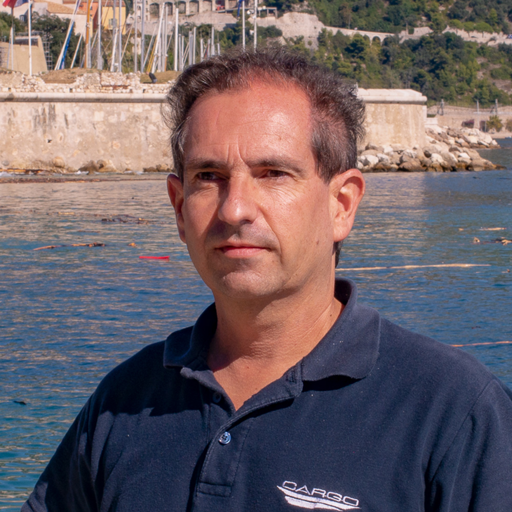
David Doxaran

Current position :

2007-present: Research Scientist

Status :

Permanent

Employer :

CNRS

Team(s) :

Hosting Lab :

LOV (UMR 7093)

Keywords :

remote sensing, optical properties, turbid coastal and estuarine waters, bio-optical modeling, atmospheric corrections, sediment transport fluxes

Complementary Information

Facilities

PUBLICATIONS BY

David Doxaran

53 documents 🔗 HAL Profile
  • Erwann Quimbert, Florence Birol, Gwenaël Caër, Thierry Carval, Pauline Chauvet, Clemence Cotten, Sandrine Dalmar, David Doxaran, Sylvie Fiat, Julie Furiga, Cyril Germineaud, Mark Hoebeke, Dimitry Khvorostyanov, Laurence Lebourg, Mylène Lorre-Guidt, Caroline Mercier, Yacine Moufid, Dominique Obaton, Steven Piel, Jean-Francois Piolle, Nicolas Pouvreau, Céline Quentin, Catherine Schmechtig, Sabine Schmidt, Joël Sudre, Alexandra Touzeau. REPORT
    Abstract

    Le pôle ODATIS de l'IR Data Terra publie son rapport d'activités 2025, qui synthétise les activités et les actions menées durant l'année passée à l'échelle du pôle, de ses Centres de Données et Services et au travers de son implication dans différents projets nationaux et européens et dans les instances de l'IR Data Terra. Ce rapport témoigne de l'intensité de l'activité du pôle, des résultats accomplis, des développements en cours, de l'évolution de l'offre des données, outils et services qui représentent autant un bilan qu'un fil stratégique pour mieux cibler, fédérer et coordonner les besoins de la communauté océanographique et de l'observation de la Terre.

  • M. Geoffroy, A. Limoges, M. Ardyna, L. Matthes, P. Archambault, G. Barut, G. Bécu, S. Bélanger, A.P. Belko, E. Bertrand, G. Blais, C. Brice, L. Brunner, T. Burgers, D. Capelle, J. Charette, T. Combaz, M. Daase, A. Desmarais, D. Doxaran, B. Else, K. Evans, S.H. Ferguson, K.R.N. Florko, A. Fox, J. Girard, B. Harker, E. Jacobsen, K.F. Johnson, E. Kitching, K. Koerner, P. Lajeunesse, M. Lee, R. Maclean, F. Maps, J.-C. Montero-Serrano, K. Nieto, A. Normandeau, M. Pucko, S. Ribeiro, A. Rochon, K. Schuler, C. Stancu, G. St-Onge, J.-É. Tremblay, N. van Nieuwenhove, D. Walch, Z. Walker, P. White, D. Yurkowski, C. Michel. Arctic Science (2026). ART
    Abstract

    The Lasting Ice Area along the northern coastline of Ellesmere Island and Greenland will be the region where Arctic multiyear sea ice will persist the longest in a warming climate, making this area critical for ice-dependent species. In 2019, the Tuvaijuittuq Marine Protected Area was established for the interim protection of the waters off northern Ellesmere Island. We present the first comprehensive study of the Archer Fiord-Lady Franklin Bay system located at the northern end of Nares Strait, in the Tuvaijuittuq area. Data on the hydrography, biogeochemical cycles, pelagic and benthic productivity, and seabed sediment were collected along a nearshore-offshore transect. The region is influenced by meteoric waters as well as Pacific and Atlantic-derived waters, and likely acts as a strong seasonal CO 2 sink. Despite fall-bloom conditions, low primary, secondary, and benthic productivity contrasted with the relatively high abundance of marine mammals. This productivity paradox either suggests (1) that organic matter and detritus deposited and accumulated over long periods prior to our survey sustain the benthic community on which marine mammals depend for foraging; (2) local productivity hotspots in areas outside the sampled stations; or (3) a highly efficient system with minor production surpluses. Solving this paradox will require further surveys in the area.

  • Samuel Martin, Pierre Gernez, Philippe Bryère, Sylvain Rigaud, David Doxaran, Nicolas Mayot. Ecological Indicators (2026). ART
    Abstract

    Coastal lagoons are productive yet vulnerable ecosystems exposed to strong anthropogenic pressures. The Berre Lagoon (southern France) illustrates this vulnerability, having undergone long-term degradation from large freshwater, nutrient and sediment inputs. Using a decade of calibrated and validated Sentinel-2 satellite observations (2015-2025), this study demonstrates the value of Earth Observation (EO) for Water Framework Directive (WFD) assessment and operational lagoon management. Satellite-derived chlorophyll-a concentration ([chl-a]), suspended particulate matter ([SPM]) and Secchi depth (Zs) were used to derive WFD-consistent indicators: the phytoplankton biomass Ecological Quality Ratio (EQR B ), an SPM-based hydropower discharge indicator, and a Zs-derived Potential Seagrass Habitat (PSH). Results show that eutrophication assessed from satellite is more severe than suggested by the current WFD monitoring network, which fails to capture major phytoplankton blooms occurring from late summer to early winter. Satellite-derived [SPM] time series also reveal a shift in hydropower operation from near-continuous discharges (2016-2021) to winter-restricted releases after 2022. This transition increased summer water transparency and expanded light-suitable seagrass habitat by about 15% (PSH ≈ 26 km 2 ), exceeding the 15 km 2 threshold required for "good" macrophyte status. Overall, this study shows how satellite observations can diagnose changes in anthropogenic pressures, monitor management-driven recovery, and provide actionable indicators for WFD implementation in coastal lagoons.

  • Yafei Luo, Zhengyu Hou, Yanxia Liu, David Doxaran, Dongyang Fu, Liwen Yan, Haijun Huang. Remote Sensing (2025). ART
    Abstract

    The Water and Sediment Regulation Scheme (WSRS), implemented since 2002, has been essential for controlling water flow and mitigating sediment siltation in the lower Yellow River. However, WSRS was suspended for the first time in 2016 and 2017 due to extremely low water flow. The rapid floodwater discharge over roughly 20 days conducted by WSRS strongly impacts total suspended solids (TSS) distribution in the Yellow River Estuary (YRE). This study employs high-frequency Sentinel-3 OLCI satellite imagery to investigate intraday TSS variations in the YRE under new water-sediment regulation conditions from 2016 to 2023. TSS concentrations were generally low during the 2016 and 2017 flood seasons, but increased markedly after WSRS resumed in 2018. Peak TSS values occurred in July or August, sometimes extending into September and October during autumn floods. A moderately strong positive correlation was observed between TSS concentrations at the river mouth and sediment load at Lijin Station during the flood seasons. The 2018 WSRS event generated an extensive river plume, with average TSS concentrations at the river mouth exceeding 400 g•m -3 . From 2018 to 2023, TSS concentrations exhibited a declining trend during flood seasons, attributed to reduced sediment discharge and ongoing sediment accretion in the Yellow River Delta. Our findings highlight Sentinel-3 OLCI as a powerful tool to resolve WSRS-driven sediment dynamics, offering critical guidance for estuarine management.

  • Samuel Martin, Philippe Bryère, Pierre Gernez, Pannimpullath Remanan Renosh, David Doxaran. Remote Sensing (2025). OTHER
    Abstract

    <div>What are the main findings?<p>• A new algorithm estimates bottom contamination probability from Sentinel-2 MSI reflectance, enabling the detection of optically shallow coastal waters. • A near-infrared/blue spectral ratio algorithm improves chlorophyll-a retrieval in optically shallow lagoons compared to traditional algorithms.</p></div> <div>What is the implication of the main finding?<p>• A full processing chain was developed and validated for high-resolution remotesensing of water quality in optically complex coastal lagoons.</p><p>• The method provides a robust framework for the operational monitoring of anthropogenically impacted lagoon systems using Sentinel-2 MSI.</p></div>

  • Kevin George Ruddick, Agnieszka Bialek, Vittorio Ernesto Brando, Ana Ines Dogliotti, David Doxaran, Clemence Goyens. Frontiers in Remote Sensing (2025). ART
  • Quinten Vanhellemont, Ana Dogliotti, David Doxaran, Clémence Goyens, Kevin Ruddick, Dieter Vansteenwegen. International Journal of Remote Sensing (2024). ART
    Abstract

    The Visible Infrared Imaging Radiometer Suite (VIIRS) is a visible, near and shortwave, to thermal infrared multispectral scanning instrument operational on three polar orbiting satellites, Suomi-NPP, JPSS-1, and JPSS-2. In the present paper, the processing of VIIRS using ACOLITE is introduced, using the Dark Spectrum Fitting (DSF) algorithm for processing of the visible to shortwave infrared bands. ACOLITE now includes support for processing both the imaging (I) and moderate (M) resolution bands at 375 m and 750 m spatial resolution, respectively. In most conditions encountered in the present study, the SWIR bands (either I or M) are automatically selected by the DSF for performing the aerosol correction. The processing is evaluated for turbid water remote sensing via autonomous hyperspectral radiometry from four sites across coastal and estuarine waters: two sites in Belgium and one each in France and Argentina. Through analysis of hundreds of matchups between the satellite and in situ measurements, a generally good performance is found for both I and M bands, especially for bands with the largest water signal, i.e. bands between 490 and 670 nm, where on average relative differences of 10-15% were found. Reflectance biases are generally less than 0.01, with a negative sign in the green and red bands and a positive sign in the blue and NIR bands. Similar matchup results are found for the I and M red and NIR bands, with a slightly higher scatter for the NIR bands. An additional comparison with OCSSW/l2gen processing of the M band data is performed for various configurations. Overall, DSF performance is better in the visible bands, whereas l2gen outputs are more closely aligned with the in situ measurements in the NIR. On average, negative biases are found for all l2gen configurations, up to -0.02 in the blue bands. Using either the SWIR1 + 2 or SWIR1 + 3 bands for the aerosol correction gives the best performance for l2gen processing. For the three VIIRS instruments separately, the average spectral differences with in situ measurements are comparable, with the most important deviation occurring at the Suomi-NPP shortest blue bands, where DSF processing gives a larger positive bias, up to nearly 0.02. For these bands, results from l2gen correspond more closely across the three instruments – although with significant negative biases for all three sensors up to −0.02 – presumably due to the use of system vicarious calibration gains in that processor. An operational network of autonomous hyperspectral instruments provides validation data for any overpassing optical imaging satellite in its commissioning or operational phase and eliminates the need for spectral interpolation or band shifting. In the case of VIIRS specifically, the hyperspectral instruments provide adequate data for the validation of the 20, 40 and 80 nm wide bands. With three operational wide-swath instruments, which provide largely interoperable data, a high frequency of observations is available, especially for study areas at higher latitudes. The novel exploitation of the I bands is now possible, thanks to the free and open source availability of ACOLITE. The advantage of the higher resolution I band data, combined with multiple VIIRS overpasses per day, is demonstrated for mapping turbidity in nearshore regions with high spatial variabilty and for detecting under-resolved floating algae.

  • Thierry Tormos, David Doxaran. Atelier Thématique Interpôles Données, Méthodes et Services pour le Littoral (2024). COMM
  • Sophie Ayrault, Gilles Pinay, Eric Ferrage, Nizar Abcha, Philippe Ackerer, Julien Ackerer, Cécile H. Albert, Elena Alekseenko, Anne Alexandre, Marie Alexis, Thierry Allard, Pierre Amato, Philippe Amiotte-Suchet, David Amouroux, Anne-Sylvie André-Mayer, Sandrine Anquetin, Eric Armynot Du Châtelet, Marie Arnaud, Nicolas Olivier Arnaud, Cécile Asanuma-Brice, Dominique Aubert, Mélanie Auffan, Julie Aufort, Cédric Bacour, Etienne Balan, Valérie Ballu, Agnès Baltzer, Pierre Barré, Maialen Barret, P. Bauda, Audrey Beaussart, Beatrice Bechet, Thierry Beguiristain, Benjamin Belfort, Frida Ben Rais Lasram, Lucilla Benedetti, Marc F. Benedetti, Anne-Claire Bennis, Catherine Bertrand, Éric Beucler, Patrick Billard, Gilles Billen, Elise Billoir, Françoise Binet, Anne-Kristel Bittebiere, Stéphane Blanc, Marc Blanchard, J Blanchet, Helene Blanchoud, Damien Blaudez, Julien Boé, Patricia Bonin, Myriam Bormans, Gudrun Bornette, Julien Bouchez, Camille Bouchez, Brice Boudevillain, Guillaume Bouger, Olivier Bour, François Bourrin, Philippe Bousquet, Anne Bousquet-Mélou, Isabelle Braud, Odile Bruneel, Yves Brunet, Elisa Bruni, Hélène Budzinski, Damien Calmels, Isabelle Calmet, Simon Damien Carrière, Corinne Casiot, Antoine Casquin, Charlotte Catrouillet, Florence Cayocca, Aurélie Cébron, François Chabaux, Aude Chambodut, Nicolas Champollion, Bruno Charrière, Mathieu Chassé, Ghassan Chebo, P. Choler, Pascal Claquin, Jean-Martial Cohard, Steeve Comeau, Yoann Copard, Marie-Christine Cormier-Salem, Samuel Coussy, Alain Crave, Julien Crétat, Philippe Cuny, Carole Dalin, Michael Danger, José Darrozes, Karin Dassas, Emilie Dassié, Olivier Dauteuil, Mélanie Davranche, Jean-Raynald de Dreuzy, Olivier de Viron, François de Vleeschouwer, Maxime Debret, Christophe Delacourt, Christine Delire, Julien Deloffre, Claire Delon, Nicolas Delpierre, Jérôme Demarty, Delphine Destoumieux-Garzon, Simon Devin, Laurent Dezileau, Aline Dia, Jean-François Doussin, David Doxaran, Laurent Drapeau, Agnès Ducharne, Jérôme F.L. Duval, Céline Duwig, Fabien Esculier, Agathe Euzen, Olivier Evrard, Pierre Faure-Catteloin, Cyrille Flamant, Cyril Fleurant, Marianne Font-Ertlen, Julien Fouché, Anthony Foucher, Matthieu Fournier, Clémentine Fritsch, François Fromard, Lucille Furgerot, Jérôme Gaillardet, Catherine Galy, Laure Gandois, Antoine Gardel, Josette Garnier, Simon Gascoin, Cécile Gautheron, Mathieu Gautier, Frédéric Gérard, Emmanuelle Geslin, Laure Giamberini, Martin Giard, Ludovic Gielly, Charline Giguet-Covex, Daniel Gilbert, Virginie Girard Girard, Sébastien Gogo, Claire Golléty, Dominique Gommery, Swanne Gontharet, Vincent Gordard, Aurélie Goutte, Regis. Grimaud, Bertrand Guenet, Laure Guerit, Elodie Guignon, Stephane Guillot, Éric Guilyardi, Damien Guinoiseau, Vincent Guinot, Remy Guyoneaud, Florence Habets, Sophia V. Hansson, Basile Hector, Marina Hery, A. Hofmann, Martine Hossaert-Mckey, Fabien Hubert, Gwenael Imfeld, Françoise Immel, M.-P. Isaure, Jérémy Jacob, Abderrahim Jardani, Emilie Jardé, Lionel Jarlan, Laurent Jeanneau, Stanislav Jelavić, Marc Jolivet, Dominique Joly, Anne Jost, Damien Jougnot, Jean Kempf, Philippe Kerhervé, B.K. Hassani, Sylvain Kuppel, Pierre Labadie, Jérôme Labanowski, Thierry Labasque, Jérôme Labille, Patrick Lachassagne, Yvan Lagadeuc, France Lagroix, Dimitri Lague, Laurent Lanceleur, Bruno Lanson, Martine Lanson, Goulven Gildas Laruelle, Béatrice Lauga, Anniet M. Laverman, Valérie Le Dantec, Séverine Le Faucheur, Annaig Leguen, Marie Le Jean, Pierre Le Pape, Romain Leclercq, Hélène Lecomte, Marine Legrand, Jean-François Léon, Nolwenn Lesparre, Laurence Lestel, C. Levard, Jean-Marc Limousin, Emily Lloret, Esméralda Longépée, Laurent Longuevergne, Fanny Louis, Wolfgang Ludwig, Fabienne Maignan, Grégoire Maillet, Odin Marc, Cyril Marchand, Guillaume Marchand, Virginie Marécal, Christelle Marlin, Yves Marrochi, Remi Marsac, Beatrice Marticorena, Jean-Michel Martinez, Jean Martins, Jérémy Masbou, Armand Masion, Nicolas Massei, Sylvie Massemin, Olivier Mathieu, Olivier Merlin, Édouard Metzger, Arnaud Mialon, Emma Michaud, Raymond Michels, Laurent Michot, Valerie Michotey, Cécile Militon, Laetitia Minguez, Florence Moatar, Florence Moatar, Gilles Molinie, Leslie Mondamert, Anne Mone, Mathilde Monperrus, Jean-Sébastien Moquet, Valérie Morel, Guillaume Morin, Samuel Morin, Dominique Mouazé, Jean-Marie Mouchel, Emilie Muller, Benjamin Musnier, Jean Nabucet, Sylvie Nazaret, Julien Némery, Nathalie Niquil, Priscia Oliva, Laurent Orgogozo, Catherine Ottle, Ludovic Oudin, Christophe Pagnout, Carmen Palacios, Gérémy Panthou, Guillaume Paris, Pierre-Yves Pascal, Sylvain Payraudeau, Thierry Pellarin, Manuel Pelletier, Jean Louis Perrin, Fabienne Petit, Sabine Petit, Christophe Peugeot, Jean-Philippe Pezy, Caroline Pierre, Marie-Claire Pierret, Anne-Catherine Pierson-Wickmann, Thierry Pigot, Raphaël Pik, Sébastien Pinel, Christophe Piscart, Valérie Plagnes, Sandrine Plaud-Guérin, Pascal Poupin, Hugues Preud'Homme, Sophie Prud'Homme, Anne Puissant, Cécile Quantin, Antoine Rabatel, Christophe Rabouille, Damien Raclot, Olivier Ragueneau, Mélanie Raimonet, Jean Louis Rajot, Guillaume Ramillien, Anthony Ranchou-Peyruse, Fayçal Rejiba, David Renault, Pierre Renault, Eléonore Resongles, Céline Reylé, Jean Riotte, Henri Robain, Tony Robinet, Philippe Roche, Fabrice Rodriguez, Jérôme Rose, Isabelle Ruin, Cornelia Rumpel, Christian Salles, Elodie Salmon, Geraldine Sarret, Géraldine Sarthou, Thomas Saucède, Sabine Sauvage, Nicolas Savoye, I. Schimmelpfennig, Dirk S Schmeller, François Schmitt, Johann Schnyder, Mathieu Sebilo, Loïc Ségalen, Antoine Séjourné, Alexei Sentchev, Lucía Seoane, Liudmila S Shirokova, Marie Silvestre, Anaëlle Simonneau, Yann Sivry, Delphine Six, Marisol Goñi, Jeroen E. Sonke, Aldo Sottolichio, Cyprien Soulaine, Tiphaine Tallec, Roman Teisserenc, Bernadette Tessier, Mickaël Tharaud, Julien Thevenot, Thomas Thiebault, Éric Thiébaut, Vincent Thieu, Gérard Thouzeau, Vanessa Tocut, Christophe Tournassat, Danièle Valdés-Lao, E.D. van Hullebusch, Delphine Vantelon, D. Verfaillie, Nathalie Vigier, Cyrille Violle, Didier Voisin, Nicolas Vuichard, Stéphane Vuilleumier, Xiaoni Wang-Faivre, Sylvain Weill, Gaël Le Roux, Bastien Wild, A. Zegeye, Pierpaolo Zuddas, Aubin Thibault de Chanvalon. REPORT

  • Vincent Vantrepotte, Trung Kien Tran, Hubert Loisel, Cédric Jamet, François G Schmitt, Sabine Schmitt, Nicolas Savoye, David Doxaran, Pierre Gernez, Francis Gohin, Matthieu Puigt, Franck Dufrenois, Jean-Louis Blin. Colloque ILICO / EVOLECO 2021 (2021). COMM
    Abstract

    La mise en place de plusieurs réseaux nationaux d’observation in situ (e.g. SOMLIT, REPHY, COAST-HF,..) ainsi que les récents développements méthodologiques en terme d’observation spatiale dite « couleur de l’eau » à l’échelle nationale permettent désormais de suivre la dynamique des eaux côtières françaises à de multiples échelles spatiales ou temporelles. L’exploitation de ces informations terrain ou satellite, généralement effectuée de manière indépendante, doit cependant faire face à différentes limitations propres aux observations in situ (e.g. faible emprise spatiale : données localisées et nombre de stations limité au sein d’un même site ou le long du littoral) ou aux données satellitaires (e.g. incertitudes sur les produits, fréquence d’acquisition, couverture temporelle réduite). Le projet OSYNICO (TOSCA/CNES) a été défini dans ce contexte et a pour objectif général de démontrer l’avantage de la complémentarité des observations in situ et satellite pour 1) décrire les évolutions à long terme (évolution des signaux moyens et des oscillations saisonnières) des caractéristiques biogéochimiques des eaux côtières françaises (de l’échelle locale à l’échelle synoptique) 2) d’apprécier l’impact des évènements climatiques extrêmes sur ces écosystèmes côtiers. Les bases de données et outils/métriques mis en place dans le cadre du projet pour la comparaison des dynamiques observées pour des variables clés (e.g. Chla, MES, POC) via les observations in situ et couleur seront présentés. Un focus sera effectué sur les premiers résultats obtenus aux échelles saisonnières et interannuelles.

  • Philippe Massicotte, Rainer Amon, David Antoine, Philippe Archambault, Sergio Balzano, Simon Bélanger, Ronald Benner, Dominique Boeuf, Annick Bricaud, Flavienne Bruyant, Gwenaëlle Chaillou, Malik Chami, Bruno Charrière, Jianfang Chen, Hervé Claustre, Pierre Coupel, Nicole Delsaut, David Doxaran, Jens Ehn, Cédric Fichot, Marie-Hélène Forget, Pingqing Fu, Jonathan Gagnon, Nicole Garcia, Beat Gasser, Jean-François Ghiglione, Gabriel Gorsky, Michel Gosselin, Priscillia Gourvil, Yves Gratton, Pascal Guillot, Hermann J. Heipieper, Serge Heussner, Stanford B. Hooker, Yannick Huot, Christian Jeanthon, Wade Jeffrey, Fabien Joux, Kimitaka Kawamura, Bruno Lansard, Edouard Leymarie, Heike Link, Connie Lovejoy, Claudie Marec, Dominique Marie, Johannie Martin, Jacobo Martin, Guillaume Massé, Atsushi Matsuoka, Vanessa Mckague, Alexandre Mignot, William L. Miller, Juan-Carlos Miquel, Alfonso Mucci, Kaori Ono, Eva Ortega-Retuerta, Christos Panagiotopoulos, Timothy Papakyriakou, Marc Picheral, Dieter Piepenburg, Louis Prieur, Patrick Raimbault, Josephine Ras, Rick A. Reynolds, André Rochon, Jean-Francois Rontani, Catherine Schmechtig, Sabine Schmidt, Richard Sempere, Yuan Shen, Guisheng Song, Dariusz Stramski, Eri Tachibana, Alexandre Thirouard, Imma Tolosa, Jean-Éric Tremblay, Mickael Vaïtilingom, Daniel Vaulot, Frederic Vaultier, John K. Volkman, Jorien E. Vonk, Huixiang Xie, Guangming Zheng, Marcel Babin. Earth System Science Data (2021). ART
    Abstract

    The MALINA oceanographic campaign was conducted during summer 2009 to investigate the carbon stocks and the processes controlling the carbon fluxes in the Mackenzie River estuary and the Beaufort Sea. Dur- ing the campaign, an extensive suite of physical, chemical and biological variables was measured across seven shelf–basin transects (south-north) to capture the meridional gradient between the estuary and the open ocean.Key variables such as temperature, absolute salinity, radiance, irradiance, nutrient concentrations, chlorophyll-a concentration, bacteria, phytoplankton and zooplankton abundance and taxonomy, and carbon stocks and fluxes were routinely measured onboard the Canadian research icebreaker CCGS Amundsen and from a barge in shallow coastal areas or for sampling within broken ice fields. Here, we present the results of a joint effort to tidy and standardize the collected data sets that will facilitate their reuse in further studies of the changing Arctic Ocean.

  • Thierry Blasco, Christophe Migon, Guillaume Morin, Aurélie Dufour, Nathalie Vigier, Sabine Marty, David Doxaran. Geo-Marine Letters (2021). ART
    Abstract

    The characterization of particles in suspension in river plumes contributes to the assessment of net particulate organic carbon (POC) fluxes and to a better understanding of the anthropogenic and climatic impact on blue carbon. Prior to POC analysis in natural waters, inorganic carbon (in the form of carbonates) must be removed. This step is generally carried out by acid leaching. However, the presence of mineral matrices (in turbid waters) may hinder total decarbonation, which may result in biased measurements. This work checks the quality of decarbonation through the analysis of carbon stable isotope ratio (δ 13 C), considering suspended particles discharged by three rivers into coastal waters under flooding conditions. Carbonates were removed by adding variable volumes of 2N hydrochloric acid (HCl) to filters. Carbon concentrations and stable isotopic ratios were analyzed. Values of δ 13 C org (stable isotope ratio of organic carbon) allow the identification of incompletely decarbonated samples. If a small amount of detrital carbonates resists the usual decarbonation treatment, δ 13 C org can be significantly shifted towards less negative values, suggesting the need of more efficient decarbonation methods in order to improve the accuracy of organic carbon measurements. Even in the case of a high C org /C total ratio, the impact of remaining carbonates on the δ 13 C org value is strong because δ 13 C inorg is significantly different. The sensitivity of δ 13 C org measurement might therefore be used to validate POC measurements in estuarine and coastal waters.

  • Jean-Pierre Gattuso, Bernard Gentili, David Antoine, David Doxaran. Earth System Science Data (2020). ART
    Abstract

    A 21 year (1998–2018) continuous monthly data set of the global distribution of light (photosyntheti-cally available radiation, PAR, or irradiance) reaching the seabed is presented. This product uses ocean color andbathymetric data to estimate benthic irradiance, offering critical improvements on a previous data set. The timeseries is 4 times longer (21 versus 5 years), the spatial resolution is better (pixel size of 4.6 versus 9.3 km at theEquator), and the bathymetric resolution is also better (pixel size of 0.46 versus 3.7 km at the Equator). The paperdescribes the theoretical and methodological bases and data processing. This new product is used to estimate thesurface area of the seafloor where (1) light does not limit the distribution of photosynthetic benthic organismsand (2) net community production is positive. The complete data set is provided as 14 netCDF files available onPANGAEA (Gentili and Gattuso, 2020a, https://doi.org/10.1594/PANGAEA.910898). The R packageCoastal-Light, available on GitHub (https://github.com/jpgattuso/CoastalLight.git, last access: 29 July 2020), allows us(1) to download geographical and optical data from PANGAEA and (2) to calculate the surface area that receivesmore than a given threshold of irradiance in three regions (nonpolar, Arctic, and Antarctic). Such surface areascan also be calculated for any subregion after downloading data from a remotely and freely accessible server

  • Yafei Luo, David Doxaran, Quinten Vanhellemont. Remote Sensing (2020). ART
    Abstract

    This study investigated the use of frequent metre-scale resolution Pléiades satellite imagery to monitor water quality parameters in the highly turbid Gironde Estuary (GE, SW France). Pléiades satellite data were processed and analyzed in two representative test sites of the GE: 1) the maximum turbidity zone and 2) the mouth of the estuary. The main objectives of this study were to: (i) validate the Dark Spectrum Fitting (DSF) atmospheric correction developed by Vanhellemont and Ruddick (2018) applied to Pléiades satellite data recorded over the GE; (ii) highlight the benefits of frequent metre-scale Pléiades observations in highly turbid estuaries by comparing them to previously validated satellite observations made at medium (250/300 m for MODIS, MERIS, OLCI data) and high (20/30 m for SPOT, OLI and MSI data) spatial resolutions. The results show that the DSF allows for an accurate retrieval of water turbidity by inversion of the water reflectance in the near-infrared (NIR) and red wavebands. The difference between Pléiades-derived turbidity and field measurements was proven to be in the order of 10%. To evaluate the spatial variability of water turbidity at metre scale, Pléiades data at 2 m resolution were resampled to 20 m and 250 m to simulate typical coarser resolution sensors. On average, the derived spatial variability in the GE is lower than or equal to 10% and 26%, respectively, in 20-m and 250-m aggregated pixels. Pléiades products not only show, in great detail, the turbidity features in the estuary and river plume, they also allow to map the turbidity inside ports and capture the complex spatial variations of turbidity along the shores of the estuary. Furthermore, the daily acquisition capabilities may provide additional advantages over other satellite constellations when monitoring highly dynamic estuarine systems.

  • Juliana Tavora, Emmanuel Boss, David Doxaran, Paul Hill. Remote Sensing (2020). ART
    Abstract

    Suspended Particulate Matter (SPM) is a major constituent in coastal waters, involved in processes such as light attenuation, pollutant propagation, and waterways blockage. The spatial distribution of SPM is an indicator of deposition and erosion patterns in estuaries and coastal zones and a necessary input to estimate the material fluxes from the land through rivers to the sea. In-situ methods to estimate SPM provide limited spatial data in comparison to the coverage that can be obtained remotely. Ocean color remote sensing complements field measurements by providing estimates of the spatial distributions of surface SPM concentration in natural waters, with high spatial and temporal resolution. Existing methods to obtain SPM from remote sensing vary between purely empirical ones to those that are based on radiative transfer theory together with empirical inputs regarding the optical properties of SPM. Most algorithms use a single satellite band that is switched to other bands for different ranges of turbidity. The necessity to switch bands is due to the saturation of reflectance as SPM concentration increases. Here we propose a multi-band approach for SPM retrievals that also provides an estimate of uncertainty, where the latter is based on both uncertainties in reflectance and in the assumed optical properties of SPM. The approach proposed is general and can be applied to any ocean color sensor or in-situ radiometer system with red and near-infra-red bands. We apply it to six globally distributed in-situ datasets of spectral water reflectance and SPM measurements over a wide range of SPM concentrations collected in estuaries and coastal environments (the focus regions of our study). Results show good performance for SPM retrieval at all ranges of concentration. As with all algorithms, better performance may be achieved by constraining empirical assumptions to specific environments. To demonstrate the flexibility of the algorithm we apply it to a remote sensing scene from an environment with highly variable sediment concentrations.

  • Pannimpullath Renosh, David Doxaran, Liesbeth de Keukelaere, Juan Ignacio Gossn. Remote Sensing (2020). ART
    Abstract

    The present study assesses the performance of state-of-the-art atmospheric correction (AC) algorithms applied to Sentinel-2-MultiSpectral Instrument (S2-MSI) and Sentinel-3-Ocean and Land Color Instrument (S3-OLCI) data recorded over moderately to highly turbid estuarine waters, considering the Gironde Estuary (SW France) as a test site. Three spectral bands of water-leaving reflectance (Rhow) are considered: green (560 nm), red (655 or 665 nm) and near infrared (NIR) (865 nm), required to retrieve the suspended particulate matter (SPM) concentrations in clear to highly turbid waters (SPM ranging from 1 to 2000 mg/L). A previous study satisfactorily validated Acolite short wave infrared (SWIR) AC algorithm for Landsat-8-Operational Land Imager (L8-OLI) in turbid estuarine waters. The latest version of Acolite Dark Spectrum Fitting (DSF) is tested here and shows very good agreement with Acolite SWIR for OLI data. L8-OLI satellite data corrected for atmospheric effects using Acolite DSF are then used as a reference to assess the validity of atmospheric corrections applied to other satellite data recorded over the same test site with a minimum time difference. Acolite DSF and iCOR (image correction for atmospheric effects) are identified as the best performing AC algorithms among the tested AC algorithms (Acolite DSF, iCOR, Polymer and C2RCC (case 2 regional coast color)) for S2-MSI. Then, the validity of six different AC algorithms (OLCI Baseline Atmospheric Correction (BAC), iCOR, Polymer, Baseline residual (BLR), C2RCC-V1 and C2RCC-V2) applied to OLCI satellite data is assessed based on comparisons with OLI and/or MSI Acolite DSF products recorded on a same day with a minimum time lag. Results show that all the AC algorithms tend to underestimate Rhow in green, red and NIR bands except iCOR in green and red bands. The iCOR provides minimum differences in green (slope = 1.0 ± 0.15, BIAS = 1.9 ± 4.5% and mean absolute percentage error (MAPE) = 12 ± 5%) and red (slope = 1.0 ± 0.17, BIAS = −9.8 ± 9% and MAPE = 28 ± 20%) bands with Acolite DSF products from OLI and MSI data. For the NIR band, BAC provides minimum differences (slope = 0.7 ± 0.13, BIAS = −33 ± 17% and MAPE = 55 ± 20%) with Acolite DSF products from OLI and MSI data. These results based on comparisons between almost simultaneous satellite products are supported by match-ups between satellite-derived and field-measured SPM concentrations provided by automated turbidity stations. Further validation of satellite products based on rigorous match-ups with in-situ Rhow measurements is still required in highly turbid waters.

  • Yafei Luo, David Doxaran, Kevin Ruddick, Fang Shen, Bernard Gentili, Liwen Yan, Haijun Huang. Optics Express (2018). ART
    Abstract

    Evidence of water reflectance saturation in extremely turbid media is highlighted based on both field measurements and satellite data corrected for atmospheric effects. This saturation is obvious in visible spectral bands, i.e., in the blue, green and even red spectral regions when the concentration of suspended particulate matter (SPM) reaches then exceeds 100 to 1000 g.m −3. The validity of several bio-optical semi-analytical models is assessed in the case of highly turbid waters, based on comparisons with outputs of the Hydrolight radiative transfer model. The most suitable models allow to reproduce the observed saturation and, by inversion, to retrieve information on the SPM mass-specific inherent optical properties.

  • Els Knaeps, David Doxaran, Ana Dogliotti, Bouchra Nechad, Kevin Ruddick, Sindy Sterckx, Dries Raymaekers. Earth System Science Data (2018). ART
    Abstract

    The SeaSWIR dataset consists of 137 ASD (Analytical Spectral Devices, Inc.) marine reflectances, 137 total suspended matter (TSM) measurements and 97 turbidity measurements gathered at three turbid estuar-ine sites (Gironde, La Plata, Scheldt). The dataset is valuable because of the high-quality measurements of the marine reflectance in the Short Wave InfraRed I region (SWIR-I: 1000-1200 nm) and SWIR-II (1200-1300 nm) and because of the wide range of TSM concentrations from 48 up to 1400 mg L −1. The ASD measurements were gathered using a detailed measurement protocol and were subjected to a strict quality control. The SeaSWIR marine reflectance is characterized by low reflectance at short wavelengths (< 450 nm), peak reflectance values between 600 and 720 nm and significant contributions in the near-infrared (NIR) and SWIR-I parts of the spectrum. Comparison of the ASD water reflectance with simultaneously acquired reflectance from a three-radiometer system revealed a correlation of 0.98 for short wavelengths (412, 490 and 555 nm) and 0.93 for long wavelengths (686, 780 and 865 nm). The relationship between TSM and turbidity (for all sites) is linear, with a correlation coefficient of 0.96. The SeaSWIR dataset has been made publicly available (https://doi.org/10.1594/PANGAEA.886287).

  • Marco Bellacicco, Daniele Ciani, David Doxaran, Vincenzo Vellucci, David Antoine, Menghua Wang, Fabrizio d'Ortenzio, Salvatore Marullo. Remote Sensing (2018). ART
    Abstract

    Currently, observations from low-Earth orbit (LEO) ocean color sensors represent one of the most used tools to study surface optical and biogeochemical properties of the ocean. LEO observations are available at daily temporal resolution, and are often combined into weekly, monthly, seasonal, and annual averages in order to obtain sufficient spatial coverage. Indeed, daily satellite maps of the main oceanic variables (e.g., surface phytoplankton chlorophyll-a) generally have many data gaps, mainly due to clouds, which can be filled using either Optimal Interpolation or the Empirical Orthogonal Functions approach. Such interpolations, however, may introduce large uncertainties in the final product. Here, our goal is to quantify the potential benefits of having high-temporal resolution observations from a geostationary (GEO) ocean color sensor to reduce interpolation errors in the reconstructed hourly and daily chlorophyll-a products. To this aim, we used modeled chlorophyll-a fields from the Copernicus Marine Environment Monitoring Service's (CMEMS) Baltic Monitoring and Forecasting Centre (BAL MFC) and satellite cloud observations from the Spinning Enhanced Visible and Infrared Imager (SEVIRI) sensor (on board the geostationary satellite METEOSAT). The sampling of a GEO was thus simulated by combining the hourly chlorophyll fields and clouds masks, then hourly and daily chlorophyll-a products were generated after interpolation from neighboring valid data using the Multi-Channel Singular Spectral Analysis (M-SSA). Two cases are discussed: (i) A reconstruction based on the typical sampling of a LEO and, (ii) a simulation of a GEO sampling with hourly observations. The results show that the root mean square and interpolation bias errors are significantly reduced using hourly observations.

  • Sorin Constantin, David Doxaran, Anna Derkacheva, Stefani Novoa, Héloïse Lavigne. Estuarine, Coastal and Shelf Science (2018). ART
    Abstract

    The Gironde River plume area is unique in terms of Suspended Particulate Matter (SPM) dynamics. Multiple factors contribute to the variations of SPM at multiple time scales, from river outputs to wind stress, currents and tidal cycles. The formation and evolution of the Maximum Turbidity Zone (MTZ) inside the estuary also plays a significant role. Thus, detailed analyses and monitoring of the region is important for better understanding the mechanisms governing the turbid plume dynamics, for proper future management and monitoring of SPM export from the estuary to the coastal ocean. In this study we use an unprecedented volume of satellite data to capture and better understand the dynamics of the river plume. We combine two types of satellite information in order to achieve these goals: data collected by the Moderate Resolution Imaging Spectroradiometer (MODIS) and the Spinning Enhanced Visible and Infrared Imager (SEVIRI) sensors. The integrated information allows accounting for multiple time scales, i.e. from seasonal to diurnal cycles. We show and parameterize the overall effects of river discharge rates over the plume extension. Seasonal variations are also analyzed and an overall relationship between river discharge rates and plume magnitude is computed. For the first time, we clearly observe and explain the diurnal cycle of SPM dynamics in the river plume. Despite the limited capabilities of the SEVIRI sensor, geostationary data was successfully used to derive such information and results similar to in-situ datasets were obtained. The same patterns are observed, with significant increase in SPM plume during spring/ebb tide periods. Results from our study can be further used to refine sediment transport models and to gain a better perspective on the ecological implications of the sediment output in the continental shelf area.

  • Guillaume Morin, Thierry Blasco, Sabine Marty, Christophe Migon, Aurélie Dufour, Nathalie Vigier, David Doxaran. Benelux Association for Stable Isotope Scientists (BASIS) Symposium (2018). POSTER
  • Luciane Rafaele Favareto, Natália Rudorff, Milton Kampel, Robert Frouin, Rüdiger Röttgers, David Doxaran, Hiroshi Murakami, Cecile Dupouy. Remote Sensing (2018). ART
    Abstract

    The Eastern Lagoon of New Caledonia (ELNC) is a semi-enclosed system surrounded by 21 an extensive coral reef barrier. The system has been suffering impacts from climate variability and 22 anthropogenic activities, including mining exploitation, and satellite monitoring is essential to 23 detect such changes. The present study aimed to assess the bio-optical variability of the ELNC 24 during the March 2014 CALIOPE 2 cruise, and examine the applicability of ocean colour 25 algorithms. The ELNC waters were characterized as oligo-mesotrophic, with spectral dominance of 26 non-algal particles (NAP) and colored dissolved organic matter (CDOM) at the coastal stations, 27 and generally low specific optical properties. In situ radiometry, obtained using two in-water 28 approaches and compared to forward modelled remote sensing reflectance (Rrs), showed less than 29 ~20% Relative Percent Differences (RPD). Chlorophyll-a concentration estimates were highly 30 biased for both the empirical, OC4 and OC3, and semi-analytical algorithms at the coastal stations, 31 with NAP and CDOM spectral dominance. Excluding these stations, the GSM01 yielded the best 32 retrievals with 35-40% RPD. NAP plus CDOM absorption was well retrieved by all algorithms with 33 ~18% RPD, and the marine particle backscattering coefficient at 443 nm with ~40% RPD. The linear 34 matrix inversion regional algorithm has the potential to improve IOP estimates, but better 35 parameterization schemes that consider the spatiotemporal variability of the specific IOPs are still 36 needed. Water turbidity algorithms also performed reasonably well (30% RPD), making the use of 37 ocean colour satellites promising for monitoring this highly vulnerable system. 38

  • Pierre Gernez, David Doxaran, Laurent Barillé. Frontiers in Marine Science (2017). ART
    Abstract

    The algorithms of Novoa et al. (2017) and Cons et al. (2005) were recalibrated and applied to Sentinel2 data to retrieve suspended particulate matter (SPM) and chlorophyll a (chl a) concentration in the environmentally and economically important intertidal zones. Sentinel2-derived chl a and SPM concentration distributions were analyzed at the scale of an oyster farm over a variety of tidal conditions. Sentinel2 imagery was then coupled with ecophysiological modeling to analyze the influence of tide-driven chl a and SPM dynamics on oyster clearance and chl consumption rates. Within the studied oyster farming site (Bourgneuf Bay along the French Atlantic coast), chl consumption rate mirrored the changes in chl a concentration during neap tides, whereas oyster clearance and chl consumption rates were both negatively impacted by high SPM concentration during spring tides.

  • Aurélien Gangloff, Romaric Verney, David Doxaran, Anouck Ody, Claude Estournel. Continental Shelf Research (2017). ART
    Abstract

    In coastal environments, river plumes are major transport mechanisms for particulate matter, nutriments and pollutants. Ocean color satellite imagery is a valuable tool to explore river turbid plume characteristics, providing observations at high temporal and spatial resolutions of suspended particulate matter (SPM) concentration over a long time period, covering a wide range of hydro-meteorological conditions. We propose here to use the MERIS-FR (300m) Ocean Color archive (2002-2012) in order to investigate Rhone River turbid plume patterns generated by the two main forcings acting on the north-eastern part of the Gulf of Lions (France): wind and river freshwater discharge. Results are exposed considering plume metrics (area of extension, south-east-westernmost points, shape, centroid, SPM concentrations) extracted from satellite data using an automated image-processing tool. Rhone River turbid plume SPM concentrations and area of extension are shown to be mainly driven by the river outflow while wind direction acts on its shape and orientation. This paper also presents the region of influence of the Rh delta ne River turbid plume over monthly and annual periods, and highlights its interannual variability.

  • David Blondeau-Patissier, Thomas Schroeder, Lesley A. Clementson, Vittorio E. Brando, Diane Purcell, Phillip Ford, David K. Williams, David Doxaran, Janet Anstee, Nandika Thapar, Miguel Tovar-Valencia. Frontiers in Marine Science (2017). ART
    Abstract

    This study focuses on the seasonal and spatial characterization of inherent optical properties and biogeochemical concentrations in the Van Diemen Gulf and Darwin Harbour, two neighboring tropical coastal environments of Northern Australia that exhibit shallow depths (similar to 20 m), large ( >3 m) semi-diurnal tides, and a monsoonal climate. To gain insight in the functioning of these optically complex coastal ecosystems, a total of 23 physical, biogeochemical, and optical parameters were sampled at 63 stations during three field campaigns covering the 2012 wet and dry seasons, and the 2013 dry season. The total light absorption budget in the Van Diemen Gulf was dominated by non algal particles (a(NAP); >45%) during the dry season (May-October) and colored dissolved organic matter (a(CDOM); 60%) during the wet season (November-April). The combined absorption by a(NAp) and a(CDOM) generally exceeded similar to 80% of the total absorption budget from 400 to 620 nm, with phytoplankton, aphy, accounting for <20%. In Darwin Harbour, where only the dry season conditions were sampled, the total absorption budget was dominated by an equivalent contribution of a(CDOM), a(NAP), and phytoplankton. The major processes explaining the seasonal variability observed in the Van Diemen Gulf are resuspension from seasonal south-easterly trade winds in combination with the tidal energy and shallow bathymetry during the dry season months, and mostly terrestrial river runoff during the monsoon which discharge terrestrial CDOM from the surrounding wetlands. Due to light-limited conditions all year round, the particulate scattering coefficient [b(p)(555)] contributed significantly (90%) to the beam attenuation coefficient c(555), thus strongly limiting phytoplankton growth (Chlorophyll a similar to 1 mg.m(-3)). Spatially, the Van Diemen Gulf had higher total suspended solids and nutrient concentrations than Darwin Harbour, with dissolved organic carbon and acDoM subjected to photobleaching during the dry season. Key bio-optical relationships derived from this comprehensive

  • Jinah Eom, Jong-Kuk Choi, Joong-Sun Won, Joo-Hyung Ryu, David Doxaran, Kevin Ruddick, Seok Lee. Journal of Coastal Research (2017). ART
    Abstract

    The variations in suspended sediment concentration (SSC) in turbid coastal waters around Gyeonggi Bay, Korea were analyzed using multiresolution ocean-color satellite imagery. Geostationary Ocean Color Imager (GOCI) and Land Satellite 7 (Landsat-7) Enhanced Thematic Mapper Plus (ETM+) images were atmospherically corrected, and an empirical algorithm was employed to generate maps of SSCs in the study area and investigate daily and annual variabilities in coastal water turbidity. SSC values were highest around 6 hours before high tide and around low tide, and the maximum values had strong positive relations with the tidal range near the sand ridge and channel (R-2 values of 0.74 and 0.72, respectively), which implies that the main driver of the diurnal variability in SSC is resuspension of bottom sediment by tides in areas of shallow water. Annually, the maximum SSC value near the sand ridge was about 400 g m(-3), showing remarkable variation over tidal cycles, whereas it was about 10 g m(-3) in the open sea, with little variation. The SSC around the sand ridge was higher in winter than in summer, mainly because of stronger resuspension resulting from winds during the NW monsoon in winter. The SSC around the Han River estuary was higher in summer than in winter because of the river discharge, which indicates that suspended sediments supplied by the Han River do not significantly affect SSC variation in the open ocean. This study revealed that application of the high temporal resolution of GOCI, combined with the high spatial resolution of Landsat-7 ETM+, can be useful for monitoring short- and long-term variations in SSC in Korean coastal waters.

  • Gael Many, François Bourrin, Xavier Durrieu de Madron, Anouck Ody, David Doxaran, Pierre Cauchy. Progress in Oceanography (2017). ART
    Abstract

    An experiment was carried out in the Gulf of Lions (NW Mediterranean) in February 2014 to assess the temporal and spatial variability of the distribution and size of suspended particulate matter (SPM) in the Rhône Region of Freshwater Influence (ROFI). A set of observations from an autonomous underwater glider, satellite ocean color data, and meteorological and hydrological time-series data highlighted the high variability of the Rhône River surface turbid plume and presence of a bottom nepheloid layer (BNL ) that depended on wind and river discharge conditions. While continental winds pushed the surface plume offshore, marine winds pressed the plume at the coast and favored the sedimentation of as well as nourishment of the BNL. Moderate storm events favored breakage of the plume stratification and along-shelf transport of Rhône River particles. The spectral slopes of glider and satellite-derived light backscattering coefficients, γ, were used as a proxies of the SPM size distribution. The results clearly sho wed that the change of the SPM size in the nepheloid layers was induced by the flocculation of fine sediments, which became finer seaward throughout the ROFI, as well as the effect of rough weather in the breakup of flocs

  • Stefani Novoa, David Doxaran, Anouck Ody, Quinten Vanhellemont, Virginie Lafon, Bertrand Lubac, Pierre Gernez. Remote Sensing (2017). ART
    Abstract

    The accurate measurement of suspended particulate matter (SPM) concentrations in coastal waters is of crucial importance for ecosystem studies, sediment transport monitoring, and assessment of anthropogenic impacts in the coastal ocean. Ocean color remote sensing is an efficient tool to monitor SPM spatio-temporal variability in coastal waters. However, near-shore satellite images are complex to correct for atmospheric effects due to the proximity of land and to the high level of reflectance caused by high SPM concentrations in the visible and near-infrared spectral regions. The water reflectance signal ((w)) tends to saturate at short visible wavelengths when the SPM concentration increases. Using a comprehensive dataset of high-resolution satellite imagery and in situ SPM and water reflectance data, this study presents (i) an assessment of existing atmospheric correction (AC) algorithms developed for turbid coastal waters; and (ii) a switching method that automatically selects the most sensitive SPM vs. (w) relationship, to avoid saturation effects when computing the SPM concentration. The approach is applied to satellite data acquired by three medium-high spatial resolution sensors (Landsat-8/Operational Land Imager, National Polar-Orbiting Partnership/Visible Infrared Imaging Radiometer Suite and Aqua/Moderate Resolution Imaging Spectrometer) to map the SPM concentration in some of the most turbid areas of the European coastal ocean, namely the Gironde and Loire estuaries as well as Bourgneuf Bay on the French Atlantic coast. For all three sensors, AC methods based on the use of short-wave infrared (SWIR) spectral bands were tested, and the consistency of the retrieved water reflectance was examined along transects from low- to high-turbidity waters. For OLI data, we also compared a SWIR-based AC (ACOLITE) with a method based on multi-temporal analyses of atmospheric constituents (MACCS). For the selected scenes, the ACOLITE-MACCS difference was lower than 7%. Despite some inaccuracies in (w) retrieval, we demonstrate that the SPM concentration can be reliably estimated using OLI, MODIS and VIIRS, regardless of their differences in spatial and spectral resolutions. Match-ups between the OLI-derived SPM concentration and autonomous field measurements from the Loire and Gironde estuaries' monitoring networks provided satisfactory results. The multi-sensor approach together with the multi-conditional algorithm presented here can be applied to the latest generation of ocean color sensors (namely Sentinel2/MSI and Sentinel3/OLCI) to study SPM dynamics in the coastal ocean at higher spatial and temporal resolutions.

  • Sorin Constantin, Stefan Constantinescu, David Doxaran. Journal of Marine Systems (2017). ART
    Abstract

    The monitoring of coastal areas is becoming an urgent necessity in the context of increased pressure over these ecosystems due to climate change and human activities. Long term evaluation of specific parameters regarding water quality can now be achieved, thanks to the increased number of archived Earth Observation satellite data, now covering decades. Within this study, 12 years of MODIS information were used to compute surface water turbidity products that were further temporal binned into composite datasets (e.g. monthly, annual). A regional algorithm, based on local in situ measurements, was used in order to inverse remote sensing reflectance values into turbidity units. The interpretation of the final maps revealed important characteristics of the processes that play a major role in the regional turbidity dynamics. Observations were made regarding the relation between surface water turbidity and Danube River's discharge rates, winds, currents and also the bottom sedimentary characteristics of the shelf area. We discuss how different regions are affected by various external factors, depending on their geographical location, and we reinforce the idea that the river solid input is not the only parameter controlling water clarity in the Danube Delta coastal area, resuspension processes playing also an important role. (C) 2017 Elsevier B.V. All rights reserved.

  • Gaël Many, François Bourrin, Xavier Durrieu de Madron, Ivane Pairaud, Aurélien Gangloff, David Doxaran, Anouck Ody, Romaric Verney, Christophe Menniti, David Le Berre, Matthias Jacquet. Journal of Marine Systems (2016). ART
    Abstract

    An innovative experiment was carried out in the vicinity of the Rhône River mouth in February 2014. An instrumental package, composed of a CTD, a LISST-100 type B (1.25–250 μm), and a LISST-HOLO (20–2000 μm), was used to characterize the hydrological parameters and suspended particles properties (concentration, size, composition, shape, and effective density) in the region of freshwater influence (ROFI) of the Rhône River. Besides, a coastal SLOCUMglider, equipped with a CTD and optical backscattering sensors at severalwavelengths,was deployed to detail the spatial description of the hydrological parameters and some particle properties. Large river discharge (annual flood ~5000 m3 s−1) and strong wind conditions favored the dispersal of the river plume on the shelf. Surface suspended particulate matter concentrations decreased rapidly seaward from 20 mg L−1 next to the river mouth to 1.5 mgL−1 at the shelf break. A persistent bottomnepheloid layerwas observed across the shelf with concentrations decreasing from8 mg L−1 at the coast to 1 mg L−1 at the shelf break. Observations showed that most of suspended particles were mainly flocculated in micro and macro-flocs (30–400 μm) in inner-shelf waters. The particle assemblage in the Rhône River plume and in the bottomnepheloid layer became progressively finer seaward and the associated effective density increased from 370 to 1600 kgm−3. Outside the plume, planktonic organisms increasingly contributed to the total volume concentration. Finally,we demonstrated the ability of gliders, equipped with optical backscattering sensors at severalwavelengths, to describe the fine scale distributions of suspended particles, and provide an index of their size distribution.

  • Sorin Constantin, David Doxaran, Stefan Constantinescu. Continental Shelf Research (2016). ART
    Abstract

    Ocean colour remote sensing information brings important insights for monitoring coastal areas. These regions are home to important natural ecosystems and changes that occur here can have important impacts not only on the local environment, but also on connected wetlands or offshore areas. The present study proposes a new regional methodology for water turbidity retrieval using the MODES red band at 250 m spatial resolution in the Danube Delta coastal area. For this purpose, multiple in-situ turbidity observations were used in order to determine a valid relationship between data collected with turbidity meters and remote sensing reflectance obtained from satellite data. A special attention is given to the atmospheric correction of satellite data, since complex optical waters require adapted methodologies for accurate remote sensing reflectance computation. Based on products derived using the proposed algorithm, the dynamics of turbidity is evaluated for multiple time periods: from local Terra to Aqua overpasses (couple of hours), daily and monthly. Results show a clear strong connection between the Danube discharge and water turbidity in the coastal area. However other environmental parameters (e.g., wind stress) also play an important role and contribute to the magnitude of the river plume extension. (C) 2015 Elsevier Ltd. All rights reserved.

  • David Doxaran, Edouard Leymarie, Bouchra Nechad, Ana Dogliotti, Kevin Ruddick, Pierre Gernez, Els Knaeps. Optics Express (2016). ART
    Abstract

    Monte Carlo simulations are used to compute the uncertainty associated to light backscattering measurements in turbid waters using the ECO-BB (WET Labs) and Hydroscat (HOBI Labs) scattering sensors. ECO-BB measurements provide an accurate estimate of the particulate volume scattering coefficient after correction for absorption along the short instrument pathlength. For Hydroscat measurements, because of a longer photon pathlength, both absorption and scattering effects must be corrected for. As the standard (sigma) correction potentially leads to large errors, an improved correction method is developed then validated using field inherent and apparent optical measurements carried out in turbid estuarine waters. Conclusions are also drawn to guide development of future short pathlength backscattering sensors for turbid waters.

  • Anouck Ody, David Doxaran, Quinten Vanhellemont, Bouchra Nechad, Stefani Novoa, Gaël Many, François Bourrin, Romaric Verney, Ivane Pairaud, Bernard Gentili. Remote Sensing (2016). ART
    Abstract

    Ocean color satellite sensors are powerful tools to study and monitor the dynamics of suspended particulate matter (SPM) discharged by rivers in coastal waters. In this study, we test the capabilities of Landsat-8/Operational Land Imager (OLI), AQUA&TERRA/Moderate Resolution Imaging Spectroradiometer (MODIS) and MSG-3/Spinning Enhanced Visible and Infrared Imager (SEVIRI) sensors in terms of spectral, spatial and temporal resolutions to (i) estimate the seawater reflectance signal and then SPM concentrations and (ii) monitor the dynamics of SPM in the Rhône River plume characterized by moderately turbid surface waters in a micro-tidal sea. Consistent remote-sensing reflectance (Rrs) values are retrieved in the red spectral bands of these four satellite sensors (median relative difference less than ~16% in turbid waters). By applying a regional algorithm developed from in situ data, these Rrs are used to estimate SPM concentrations in the Rhône river plume. The spatial resolution of OLI provides a detailed mapping of the SPM concentration from the downstream part of the river itself to the plume offshore limits with well defined small-scale turbidity features. Despite the low temporal resolution of OLI, this should allow to better understand the transport of terrestrial particles from rivers to the coastal ocean. These details are partly lost using MODIS coarser resolutions data but SPM concentration estimations are consistent, with an accuracy of about 1 to 3 g·m−3 in the river mouth and plume for spatial resolutions from 250 m to 1 km. The MODIS temporal resolution (2 images per day) allows to capture the daily to monthly dynamics of the river plume. However, despite its micro-tidal environment, the Rhône River plume shows significant short-term (hourly) variations, mainly controlled by wind and regional circulation, that MODIS temporal resolution failed to capture. On the contrary, the high temporal resolution of SEVIRI makes it a powerful tool to study this hourly river plume dynamics. However, its coarse resolution prevents the monitoring of SPM concentration variations in the river mouth where SPM concentration variability can reach 20 g·m−3 inside the SEVIRI pixel. Its spatial resolution is nevertheless sufficient to reproduce the plume shape and retrieve SPM concentrations in a valid range, taking into account an underestimation of about 15%–20% based on comparisons with other sensors and in situ data. Finally, the capabilities, advantages and limits of these satellite sensors are discussed in the light of the spatial and temporal resolution improvements provided by the new and future generation of ocean color sensors onboard the Sentinel-2, Sentinel-3 and Meteosat Third Generation (MTG) satellite platforms.

  • Zhongping Lee, Shaoling Shang, Gong Lin, Jun Chen, David Doxaran. Applied optics (2016). ART
    Abstract

    We evaluated three key components in modeling hyperspectral remote-sensing reflectance in the visible to short-wave-infrared (Vis-SWIR) domain of high-sediment-load (HSL) waters, which are the relationship between remote-sensing reflectance (R-rs) and inherent optical properties (IOPs), the absorption coefficient spectrum of pure water (a(w)) in the IR-SWIR region, and the spectral variation of sediment absorption coefficient (a(sed)). Results from this study indicate that it is necessary to use a more generalized R-rs-IOP model to describe the spectral variation of R-rs of HSL waters from Vis to SWIR; otherwise it may result in a spectrally distorted R-rs spectrum if a constant model parameter is used. For hyperspectral a(w) in the IR-SWIR domain, the values reported in Kou et al. (1993) provided a much better match with the spectral variation of R-rs in this spectral range compared to that of Segelstein (1981). For a(sed) spectrum, an empirical a(sed) spectral shape derived from sample measurements is found working much better than the traditional exponential-decay function of wavelength in modeling the spectral variation of R-rs in the visible domain. These results would improve our understanding of the spectral signatures of R-rs of HSL waters in the Vis-SWIR domain and subsequently improve the retrieval of IOPs from ocean color remote sensing, which could further help the estimation of sediment loading of such waters. Limitations in estimating chlorophyll concentration in such waters are also discussed. (C) 2016 Optical Society of America

  • D. Doxaran, E. Devred, M. Babin. Biogeosciences (2015). ART
    Abstract

    Global warming has a significant impact on the regional scale on the Arctic Ocean and surrounding coastal zones (i.e., Alaska, Canada, Greenland, Norway and Russia). The recent increase in air temperature has resulted in increased precipitation along the drainage basins of Arctic rivers. It has also directly impacted land and seawater temperatures with the consequence of melting permafrost and sea ice. An increase in freshwater discharge by main Arctic rivers has been clearly identified in time series of field observations. The freshwater discharge of the Mackenzie River has increased by 25% since 2003. This may have increased the mobilization and transport of various dissolved and particulate substances, including organic carbon, as well as their export to the ocean. The release from land to the ocean of such organic material, which has been sequestered in a frozen state since the Last Glacial Maximum, may significantly impact the Arctic Ocean carbon cycle as well as marine ecosystems. In this study we use 11 years of ocean color satellite data and field observations collected in 2009 to estimate the mass of terrestrial suspended solids and particulate organic carbon delivered by the Mackenzie River into the Beaufort Sea (Arctic Ocean). Our results show that during the summer period, the concentration of suspended solids at the river mouth, in the delta zone and in the river plume has increased by 46, 71 and 33%, respectively, since 2003. Combined with the variations observed in the freshwater discharge, this corresponds to a more than 50% increase in the particulate (terrestrial suspended particles and organic carbon) export from the Mackenzie River into the Beaufort Sea.

  • Rüdiger Röttgers, David Doxaran, Cecile Dupouy. Optics Express (2015). ART
    Abstract

    The accurate determination of light absorption coefficients of particles in water, especially in very oligotrophic oceanic areas, is still a challenging task. Concentrating aquatic particles on a glass fiber filter and using the Quantitative Filter Technique (QFT) is a common practice. Its routine application is limited by the necessary use of high performance spectrophotometers, distinct problems induced by the strong scattering of the filters and artifacts induced by freezing and storing samples. Measurements of the sample inside a large integrating sphere reduce scattering effects and direct field measurements avoid artifacts due to sample preservation. A small, portable, Integrating Cavity Absorption Meter setup (QFT-ICAM) is presented, that allows rapid measurements of a sample filter. The measurement technique takes into account artifacts due to chlorophyll-a fluorescence. The QFT-ICAM is shown to be highly comparable to similar measurements in laboratory spectrophotometers, in terms of accuracy, precision, and path length amplification effects. No spectral artifacts were observed when compared to measurement of samples in suspension, whereas freezing and storing of sample filters induced small losses of water-soluble pigments (probably phycoerythrins). Remaining problems in determining the particulate absorption coefficient with the QFT-ICAM are strong sample-to-sample variations of the path length amplification, as well as fluorescence by pigments that is emitted in a different spectral region than that of chlorophyll-a.

  • Jean-Francois Rontani, Bruno Charrìère, Richard Sempere, David Doxaran, Frédéric Vaultier, Jorien E. Vonk, John K. Volkman. Organic Geochemistry (2014). ART
    Abstract

    Sterols and their biotic and abiotic degradation products were quantified in suspended particulate matter (SPM) from surface waters in the Mackenzie River mouth to the Beaufort Sea shelf (Canadian Arctic). 24-Ethylcholesterol (sitosterol) and 24-methylcholesterol (campesterol) appeared to be extensively degraded by bacterial and especially autoxidative degradation in the samples. Degradation was most extensive in some samples from the outer boundaries of the plume, which exhibited much higher sitosterol/campesterol ratio values than previously observed in studies of the Beaufort Sea. The lack of reactivity of specific planktonic sterols such as cholesterol, 24-methylcholesta-5,22E-dien-3β-ol (epi-brassicasterol) and 24-methylenecholesterol and the good correlation between the abundances of sitosterol, campesterol and dehydroabietic acid (DHAA, a biomarker of Pinaceae resin) oxidation products allowed us to attribute the main origin of these two sterols to terrigenous vascular plants. A good correlation was observed between the extent of autoxidation and salinity, suggesting that the free radical oxidation is enhanced via contact with seawater. Laboratory incubation of Mackenzie River SPM in Milli-Q water and seawater confirmed this proposal. To explain the specific induction of autoxidation on vascular plant-derived material, a mechanism involving homolytic cleavage of photochemically produced hydroperoxides resulting from the senescence of higher plants on land is proposed. Cleavage could be catalyzed by redox-active metal ions released from SPM in the mixing zone of riverine water and marine water. The greatest extent of degradation observed at outer boundaries of the plume is attributed to preferential settling of lithic material relative to less dense higher plant debris increasing the proportion of highly degraded vascular plant material in the SPM. The results are important for this ecologically vulnerable region, where destabilization of permafrost by global warming is expected to increase the input of terrigenous C to coastal seas. Autoxidation, which until now has received little attention, plays a key role in the degradation of vascular plant-derived lipids in surface waters and should be taken into consideration during future studies of terrigenous organic matter degradation.

  • Pierre Gernez, Laurent Barillé, Astrid Lerouxel, Constant Mazeran, Axel Lucas, David Doxaran. Journal of Geophysical Research. Oceans (2014). ART
    Abstract

    High resolution satellite data of the Medium Resolution Imaging Spectrometer in full resolution mode (MERIS FR, pixel size is 300 m) were used to study the impact of suspended particulate matter (SPM) on oyster-farming sites in a macrotidal bay of the French Atlantic coast where SPM concentration can exceed 100 g m(-3). Because MERIS standard SPM concentration retrieval saturates at about 50 g m(-3), we developed an alternative method for turbid nearshore waters. The method consists in the combination of the Semi-Analytical Atmospheric and Bio-Optical (SAABIO) atmospheric correction with a regional bio-optical algorithm based on a linear relationship between SPM concentration and the reflectance band ratio at 865 and 560 nm. MERIS FR-derived SPM concentrations were validated from 10 up to 300 g m(-3), and then merged with oyster ecophysiological responses to provide a spatial picture of the impact of SPM concentration on oyster-farming sites. Our approach demonstrates the potential of high resolution satellite remote sensing for aquaculture management and shellfish-farming ecosystems studies.

  • Bertrand Saulquin, Ronan Fablet, Pierre Ailliot, Grégoire Mercier, David Doxaran, Antoine Mangin, Odile Fanton d'Andon. IEEE Journal of Selected Topics in Applied Earth Observations and Remote Sensing (2014). ART
    Abstract

    Satellite data, with their spatial and temporal coverage, are particularly well suited for the analysis and characterization of space-time-varying relationships between geophysical processes. We investigate here the forecasting of a geophysical variable using both satellite observations and model outputs. As example we study the daily concentration of mineral suspended particulate matters estimated from satellite-derived datasets, in coastal waters adjacent to the French Gironde River mouth. We forecast this high resolution dataset using environmental data (wave height, wind strength and direction, tides and river outflow) and four multi-latent-regime models: homogeneous and non-homogeneous Markov-switching models, with and without an autoregressive term, i.e. the suspended matter concentration observed the day before. We clearly show, using a validation dataset, significant improvements with multi-regime models compared to a classical multi-regression and a state-of-the-art non-linear model (Support Vector Regression (SVR) model). The best results are reported for a mixture of 3 regimes for autoregressive model using non-homogeneous transitions. With the autoregressive models, we obtain at day+1 forecasting performances of 93% of the explained variance for the mixture model compared to 83% for a standard linear model and 85% using a SVR. These improvements are even more important for the non-autoregressive models. These results stress the potential of the identification of geophysical regimes to improve the forecasting or the inversion. We also show that for short periods of lack of observations (typically lesser than 15 days), non-homogeneous transition probabilities and estimated autoregressive term, the observation of the previous day not being available, help to enhance forecasting performances.

  • David Doxaran, Nicolas Lamquin, Young-Je Park, Constant Mazeran, Joo-Hyung Ryu, Menghua Wang, Antoine Poteau. Remote Sensing of Environment (2014). ART
  • Matthieu Bressac, Cécile Guieu, David Doxaran, François Bourrin, Karine Desboeufs, Nathalie Leblond, Céline Ridame. Biogeosciences (2014). ART
    Abstract

    Lithogenic particles, such as desert dust, have been postulated to influence particulate organic carbon (POC) export to the deep ocean by acting as mineral ballasts. However, an accurate understanding and quantification of the POC-dust association that occurs within the upper ocean is required in order to affine the "ballast hypothesis". In the framework of the DUNE project, two artificial seedings were performed seven days apart within large mesocosms. A suite of optical and biogeochemical measurements were used to quantify surface POC export following simulated dust events within a low-nutrient low-chlorophyll ecosystem. The two successive seedings led to a 2.3-6.7 fold higher POC flux as compared to the POC flux observed in controlled mesocosms. A simple linear regression analysis revealed that the lithogenic fluxes explained more than 85% of the variance in POC fluxes. At the scale of a dust deposition event, we estimated that 42-50% of POC fluxes were strictly associated with lithogenic particles through an aggregation process. Lithogenic ballasting also likely impacted the remaining POC fraction which resulted from the fertilization effect. The observations support the "ballast hypothesis" and provide a quantitative estimation of the surface POC export abiotically triggered by dust deposition. In this work, we demonstrate that the strength of such a "lithogenic carbon pump" depends on the biogeochemical conditions of the water column at the time of deposition. Based on these observations, we suggest that this "lithogenic carbon pump" could represent a major component of the biological pump in oceanic areas subjected to intense atmospheric forcing.

  • Thomas Lorthiois, David Doxaran, Malik Chami. Geo-Marine Letters (2012). ART
    Abstract

    Satellite ocean colour remote sensing can serve as a powerful tool to assess river plume characteristics because it provides daily mapping of surface suspended particulate matter (SPM) concentration at high spatial resolution. This study's ultimate objective was to better understand daily and seasonal particle dynamics in a coastal area strongly influenced by freshwater discharge and wind-the Rhne River (France), this being the major source of terrestrial input to the Mediterranean Sea. SPM concentrations and biogenic composition (chlorophyll a, organic carbon) were investigated during several bio-optical field campaigns conducted in spring-autumn of 2010 both from aboard a research vessel and by means of an autonomous profiling float. Freshwater discharge and wind velocities varied significantly during the year, associated with marked fluctuations in surface SPM (upper 1 m), even within hours and not restricted to any specific season. Thus, the range was ca. 12-25 g m(-3) (dry mass basis) on 9 April (spring), and ca. 3-39 g m(-3) on 4-5 November (late autumn). Short-term variations were observed also in SPM composition in terms of POC (albeit not chl a), with POC/SPM ratios ranging between ca. 3 and 11% over ca. 3 weeks in spring. Nevertheless, the particulate backscattering coefficient (b (bp)) proved to be a robust proxy of SPM concentration in the river plume (b (bp)(770) = 0.0076 Au SPM, R-2 = 0.80, N = 56). It has recently been demonstrated that 80% of the Rhne's terrestrial discharge occurs during flood events. The results of the present study revealed that, under these conditions, SPM is constrained largely within surface waters (i.e. at depths < 5 m), with only weak daily vertical variability. By implication, ocean colour satellite data are highly suitable in meaningfully estimating the overall SPM load exported by the Rhne River to the Mediterranean. These findings make a solid contribution to future improvements of three-dimensional sediment transport models for the region and similar settings.

  • Matthieu Bressac, Cécile Guieu, David Doxaran, Francois Bourrin, Grigor Obolensky, Jean-Michel Grisoni. Geo-Marine Letters (2012). ART
    Abstract

    It has recently been postulated that lithogenic particles such as Saharan dust strongly influence particulate organic carbon export to the deep ocean by acting as mineral ballast. However, our understanding of the processes involved remains scant. In the present study, optical measurements were performed to monitor variations in the concentration, composition and size distribution of particles in suspension within the water column after simulating a Saharan dust event in very clear Mediterranean waters off Corsica in June 2010. A new methodology set up in large mesocosms proved very successful in this regard. Values obtained simultaneously from three instruments (WetLabs ECO-BB3, WetLabs ac-9, Sequoia Scientific LISST-100) provided evidence that (1) part of the Saharan dust pool has a rapid settling velocity (similar to 24-86 m day(-1)), (2) particulate export following a dust event is a nonlinear multi-step process and (3) export is controlled in part by the formation of organic-mineral aggregates. This experimental study provides the first insight of the complex export processes occurring after a dust event involving both physical and biogeochemical forcings in clear oligotrophic waters.

  • Nicolas Lamquin, Constant Mazeran, David Doxaran, Joo-Hyung Ryu, Young-Je Park. OCEAN SCIENCE JOURNAL (2012). ART
    Abstract

    The first Geostationary Ocean Color Imager (GOCI) launched by South Korea in June 2010 constitutes a major breakthrough in marine optics remote-sensing for its capabilities to observe the diurnal cycles of the ocean. The light signal recorded at eight wavelengths by the sensor allows, after correction for Solar illumination and atmospheric effects, the retrieval of coloured biogeochemical products such as the chlorophyll, suspended sediment and coloured dissolved organic matter concentrations every hour between 9: 00 am and 4: 00 pm local time around the Korean peninsula. However operational exploitation of the mission needs beforehand a sound validation of first the radiometric calibration, i.e. inspection of the top-of-atmosphere reflectance, and second atmospheric corrections for retrieval of the water-leaving reflectance at sea surface. This study constitutes a contribution to the quality assessment of the GOCI radiometric products generated by the Korea Ocean Satellite Center (KOSC) through comparison with concurrent data from the MODerate-resolution Imaging Spectroradiometer (MODIS, NASA) and MEdium Resolution Imaging Spectrometer (MERIS, ESA) sensors as well as in situ measurements. These comparisons are made with spatially and temporally collocated data. We focus on Rayleigh-corrected reflectance (rho(RC)) and normalized remote-sensing marine reflectance (nRrs). Although GOCI compares reasonably well with MERIS and MODIS, what demonstrates the success of Ocean Colour in geostationary orbit, we show that the current GOCI atmospheric correction systematically masks out data over very turbid waters and needs further examination and correction for future release of the GOCI products.

  • Ole A. Mikkelsen, Malik Chami, David Doxaran. Geo-Marine Letters (2012). ART
    Abstract

    This special issue of Geo-Marine Letters presents selected contributions from the international conference Particles in Europe (PiE) 2010 organized by Sequoia Scientific, Inc., and the Laboratoire d'Oc,anographie de Villefranche (LOV) on 15-17 November 2010 in Villefranche-sur-Mer, France, and guest-edited by Ole Mikkelsen, Malik Chami and David Doxaran. PiE was initiated in 2008, in order to promote and further our understanding of the importance of suspended particulate matter (SPM) for a very wide range of processes in the aquatic environment-from optics and acoustics, over sediment transport, to the global carbon balance. The papers in this special issue are in particular concerned with the interaction between SPM and water optical properties, as well as how to use optical proxy measurements to understand SPM processes. The next PiE conference is scheduled for 17-19 October 2012 in Barcelona, Spain.

  • Cecile Guieu, Xavier Durrieu de Madron, Pascal Conan, Frédéric Gazeau, Claude Estournel, Richard Sempere, D. Cossa, Fabrizio d'Ortenzio, Christophe Rabouille, Lars Stemmann, Sophie Bonnet, F. Diaz, Philippe Koubbi, Olivier Radakovitch, Marcel Babin, Melika Baklouti, C. Bancon-Montigny, Sauveur Belviso, N. Bensoussan, B. Bonsang, Ioanna Bouloubassi, Christian Brunet, J.-F. Cadiou, Francois Carlotti, M. Chami, Sabine Charmasson, Bruno Charrière, J. Dachs, David Doxaran, Jean-Claude Dutay, F. Elbaz-Poulichet, Marc Eléaume, F. Eyrolles, C. Fernandez, S. Fowler, P. Francour, J.C. Gaertner, R. Galzin, Stéphane Gasparini, Jean-François Ghiglione, J.-L. Gonzalez, Catherine Goyet, Lionel Guidi, K. Guizien, Lars-Eric Heimbürger-Boavida, Stéphanie H. M. Jacquet, Wade Jeffrey, Fabien Joux, P. Le Hir, Karine Leblanc, D. Lefèvre, C. Lejeusne, Rodolphe Lemee, M.-D. Loÿe-Pilot, M. Mallet, Laurence Méjanelle, Frederic Melin, C. Mellon, B. Mérigot, P.-L. Merle, C. Migon, W.L. Miller, Laurent Mortier, B. Mostajir, L. Mousseau, T. Moutin, J. Para, T. Pérez, Anne Petrenko, J.-C. Poggiale, L. Prieur, M. Pujo-Pay, P. Raimbault, A.P. Rees, Céline Ridame, J.-F. Rontani, Diana Ruiz-Pino, Marie-Alexandrine Sicre, Vincent Taillandier, C. Tamburini, T. Tanaka, Isabelle Taupier-Letage, Marc Tedetti, Pierre Testor, H. Thébault, B. Thouvenin, F. Touratier, Jacek Tronczynski, Caroline Ulses, France van Wambeke, Vincent Vantrepotte, Sandrine Vaz, Romaric Verney. Progress in Oceanography (2011). ART
    Abstract

    The semi-enclosed nature of the Mediterranean Sea, together with its smaller inertia due to the relative short residence time of its water masses, make it highly reactive to external forcings, in particular variations of water, energy and matter fluxes at the interfaces. This region, which has been identified as a “hotspot” for climate change, is therefore expected to experience environmental impacts that are considerably greater than those in many other places around the world. These natural pressures interact with the increasing demographic and economic developments occurring heterogeneously in the coastal zone, making the Mediterranean even more sensitive. This review paper aims to provide a review of the state of current functioning and responses of Mediterranean marine biogeochemical cycles and ecosystems with respect to key natural and anthropogenic drivers and to consider the ecosystems’ responses to likely changes in physical, chemical and socio-economical forcings induced by global change and by growing anthropogenic pressure at the regional scale. The current knowledge on and expected changes due to single forcing (hydrodynamics, solar radiation, temperature and acidification, chemical contaminants) and combined forcing (nutrient sources and stoichiometry, extreme events) affecting the biogeochemical fluxes and ecosystem functioning are explored. Expected changes in biodiversity resulting from the combined action of the different forcings are proposed. Finally, modeling capabilities and necessity for modeling are presented. A synthesis of our current knowledge of expected changes is proposed, highlighting relevant questions for the future of the Mediterranean ecosystems that are current research priorities for the scientific community. Finally, we discuss how these priorities can be approached by national and international multi-disciplinary research, which should be implemented on several levels, including observational studies and modeling at different temporal and spatial scales.

  • Maeva Doron, Simon Belanger, David Doxaran, Marcel Babin. Remote Sensing of Environment (2011). ART
    Abstract

    The optical properties of natural waters beyond the visible range, in the near-infrared (NIR, 700-900 nm), have received little attention because they are often assumed to be mostly determined by the large absorption coefficient of pure water, and because of methodological difficulties. It is now growingly admitted that the NIR represents a potential optical source of unambiguous information about suspended sediments in turbid waters, thence the need for better understanding the NIR optical behaviour of such waters. It has recently been proposed (Ruddick et al., Limnology and Oceanography. 51, 1167-1179, 2006) that the variability in the shape of the surface ocean reflectance spectrum in the NIR is negligible in turbid waters. In the present study, we show, based on both in situ and remote sensing data, that the shape of the ocean reflectance spectrum in the NIR does vary in turbid to extremely turbid waters. Space-borne ocean reflectance data were collected using 3 different sensors (SeaWiFS, MODIS/Aqua and MERIS) over the Amazon, Mackenzie and Rio de la Plata turbid river plumes during extremely clear atmospheric conditions so that reliable removal of gas and aerosol effects on reflectance could be achieved. In situ NIR reflectance data were collected in different European estuaries where extremely turbid waters were found. In both data sets, a flattening of the NIR reflectance spectrum with increasing turbidity was observed. The ratio of reflectances at 765 nm and 865 nm, for instance, varied from ca. 2 down to 1 in our in situ data set, while a constant value of 1.61 had been proposed based on theory in a previous study. Radiative transfer calculations were performed using a range of realistic values for the seawater inherent optical properties, to determine the possible causes of variations in the shape of the NIR reflectance spectrum. Based on these simulations, we found that the most significant one was the gradual increase in the contribution of suspended sediments to the color of surface waters, which often leads to the flattening of the reflectance spectrum. Changes in the scattering and absorption properties of particles also contributed to variations in the shape of the NIR surface ocean reflectance spectrum. The impact of such variations on the interpretation of ocean color data is discussed. (C) 2011 Elsevier Inc. All rights reserved.

  • Edouard Leymarie, David Doxaran, Marcel Babin. Applied optics (2010). ART
    Abstract

    Monte Carlo simulations are used to explain and quantify the errors in inherent optical properties (IOPs) (absorption and attenuation coefficients) measured using the WET Labs AC-9 submarine spectrophot-ometer, and to assess correction algorithms. Simulated samples with a wide range of IOPs encountered in natural waters are examined. The relative errors on the measured absorption coefficient are in general lower than 25%, but reach up to 100% in highly scattering waters. Relative errors on attenuation and scattering coefficients are more stable, with an underestimation mainly driven by the volume scattering function. The errors in attenuation and scattering spectral shapes are small.

  • Caroline Petus, Guillem Chust, Francis Gohin, David Doxaran, Jean-Marie Froidefond, Yolanda Sagarminaga. Continental Shelf Research (2010). ART
    Abstract

    The Basque coastal waters (South Bay of Biscay) are directly influenced by the Adour River freshwater plume. The Adour outflow leads to important variations of suspended matter concentrations and turbidity, which in turn may affect biological productivity and water quality. This study aims at both developing specific algorithms and testing the efficiency of atmospherically corrected MODIS-Aqua 250-m surface reflectance product (MYD09) to map total suspended matter concentrations and turbidity within the Adour coastal region. First, regional empirical algorithms based on in-situ data were tested to retrieve the concentration of total suspended matter and turbidity from the remote sensing reflectance. Then, the respective sensitivity of MODIS surface reflectance bands 1 and 2 for water quality application was investigated as well as the quality of atmospheric corrections. Finally, selected algorithms were applied to the MYD09 product. The resulting 250-m resolution maps were then compared to 1000-m maps produced by IFREMER and comparisons between satellite measurements and in-situ sampling points were performed. Results show that MODIS-Aqua band 1 (620-670 nm) is appropriate for predicting turbidity and total suspended matter concentrations using polynomial regression models, whilst band 2 is unadapted. Comparison between total suspended matter concentration 250-m resolution maps and mineral suspended matter 1000-m maps (generated by IFREMER) produced consistent results. A high correlation was obtained between turbidity measured in-situ and turbidity retrieved from MODIS-Aqua satellite data. (C) 2009 Elsevier Ltd. All rights reserved.

  • David Doxaran, Kevin Ruddick, David Mckee, Bernard Gentili, Dominique Tailliez, Malik Chami, Marcel Babin. Limnology and Oceanography (2009). ART
    Abstract

    Field measurements and Mie calculations of the particulate light-scattering coefficient (b(p), in m(-1)) in the near-infrared and visible spectral domains are combined to quantify and model the effect of particulate absorption on the b(p) spectral variations. The case of particles of coastal origin and assumed to follow a Junge-type size distribution is considered. A simple power-law function closely reproduces the near-infrared b(p) spectral variations, with a spectral slope varying in the range 0.1-1.4. In the visible (e.g., 440 nm), particulate absorption effects systematically lead to b(p) values 5-30% lower than values predicted using a power-law function fitted in the near infrared and extrapolated to 440 nm. The respective influences of the particle size distribution and composition are investigated for both mineral and organic particle populations. Finally, an empirical model derived from theoretical calculations closely reproduces the actual b(p) spectral variations from near-infrared to short visible wavelengths, taking into account particulate absorption effects.

  • David Mckee, Malik Chami, Ian Brown, Violeta Sanjuan Calzado, David Doxaran, Alex Cunningham. Applied optics (2009). ART
    Abstract

    The particulate backscattering ratio (b(bp)/b(p)) is a useful indicator of the angular scattering characteristics of natural waters. Recent studies have shown evidence both for and against significant spectral variability in b(bp)/b(p) in the visible domain, but most show significant variability in its magnitude. We present results from a case study in which both backscattering and scattering coefficients were measured at nine wavelengths in a region of UK coastal waters where optical scattering is strongly influenced by inorganic particles and where a wide range of turbidities is found in a small geographic area. Using a new approach based on regression analysis of in situ signals, it is shown that, for this study site, most of the apparent variability in the magnitude of the backscattering ratio can be attributed to measurement uncertainties. Regression analysis suggests that b(bp)/b(p) is wavelength dependent for these mineral-rich waters. This conclusion can only be avoided by positing the existence of undocumented, systematic, wavelength-dependent errors in backscattering measurements made by two independently calibrated sensors. These results are important for radiative transfer simulations in mineral-dominated waters where the backscattering ratio has often been assumed to be spectrally flat. Furthermore, spectral dependence also has profound implications for our understanding of the relationship between b(bp)/b(p) and particle size distributions in coastal waters since the commonly assumed power-law distribution is associated with a spectrally flat particulate backscattering ratio for nonabsorbing particles. (C) 2009 Optical Society of America

  • David Doxaran, Jean-Marie Froidefond, Patrice Castaing, Marcel Babin. Estuarine, Coastal and Shelf Science (2009). ART
    Abstract

    Over a 1-year period, field and satellite measurements of surface water turbidity were combined in order to study the dynamics of the turbidity maximum zone (TM) in a macrotidal estuary (the Gironde, France). Four fixed platforms equipped with turbidity sensors calibrated to give the suspended particulate matter (SPM) concentration provided continuous information in the upper estuary. Full resolution data recorded by the moderate resolution imaging spectroradiometer (MODIS) sensors onboard the Terra and Aqua satellite platforms provided information in the central and lower estuary twice a day (depending on cloud cover). Field data were used to validate a recently developed SPM quantification algorithm applied to the MODIS `surface reflectance' product. The algorithm is based on a relationship between the SPM concentration and a reflectance ratio of MODIS bands 2 (near-infrared) and 1 (red). Based on 62 and 75 match-ups identified in 2005 with MODIS Terra and Aqua data, the relative uncertainty of the algorithm applied to these sensors was found to be 22 and 18%, respectively. Field measurements showed the tidal variations of turbidity in the upper estuary, while monthly-averaged MODIS satellite data complemented by field data allowed observing the monthly movements of the TM in the whole estuary. The trapping of fine sediments occurred in the upper estuary during the period of low river flow. This resulted in the formation of a highly concentrated TM during a 4-month period. With increasing river flow, the TM moved rapidly to the central estuary. A part of the TM detached, moved progressively in the lower estuary and was finally either massively exported to the ocean during peak floods or temporary trapped (settled) on intertidal mudflats. The massive export to the ocean was apparently the result of combined favorable environmental conditions: presence of fluid mud near the mouth, high river flow, high tides and limited wind speeds. The mean SPM concentration within surface waters of the whole estuary showed strong seasonal variations but remained almost unchanged on a 1-year-basis. These observations suggest that the masses of suspended sediments exported toward the ocean and supplied by the rivers were almost equivalent during the year investigated (2005). Results show the usefulness of information extracted from combined field and current ocean color satellite data in order to monitor the transport of suspended particles in coastal and estuarine waters. (c) 2008 Elsevier Ltd. All rights reserved.